Esk Valley Walk
![]()
![]() A stunning walk through the North York Moors National Park from Castleton to Whitby.
A stunning walk through the North York Moors National Park from Castleton to Whitby.
The walk begins with a loop from Castleton which passes through Danby Head, Westerdale Moor, Farndale Moor and High Blakey Moor. You return to Castleton where you begin the next section through Esk Dale to Danby and then the climb to Danby Beacon. From here it leads to Leaholm, Glaisdale, Egton Bridge and Grosmont with several sections along the River Esk. The final section takes you through Sleights to the finish point at Whitby, on the North Sea. See the Sleights to Whitby Walk for more details on this nice section.
The walk passes the North York Moors Railway which you can take for part of the route. The steam railway is a significant tourist attraction and may be the busiest steam heritage line in the world, carrying around 350,000 passengers in 2009.
Esk Valley Walk Ordnance Survey Map  - view and print off detailed OS map
Esk Valley Walk Open Street Map  - view and print off detailed map
*New* - Walks and Cycle Routes Near Me Map - Waymarked Routes and Mountain Bike Trails>>
Esk Valley Walk OS Map  - Mobile GPS OS Map with Location tracking
Esk Valley Walk Open Street Map  - Mobile GPS Map with Location tracking
Pubs/Cafes
Near Whitby you could stop off at The Bridge Inn in the little village of Ruswarp. The pub has a lovely garden area by the river where you can sit and watch the old steam trains go by. It's a splendid place to relax with a drink on warmer days. They also do very good food and have a fine selection of ales. You can find them on the High Street at a postcode of YO21 1NJ for your sat navs. It's also dog friendly if you have your canine friend with you. Near here there's also the option of climbing to the Larpool Viaduct for views over the area. The impressive 13 arch structure was built in 1882 to carry the Scarborough & Whitby Railway over the River Esk. It's now owned by Sustrans and carries the Cinder Track, a shared cycling and walking trail runnning to Robin Hood's Bay.
At the picturesque village of Egton Bridge there's the Postgate Inn to consider. The tradtional country inn dates back to 1860 and also provides bed and breakfast accommodation. The Inn was a regular feature in the popular TV series "Heartbeat" that was set in the North York Moors under its stage name "The Black Dog”. They serve good quality food and have a nice garden area to relax in on warmer days. You can find them at postcode YO21 1UX for your sat navs.
In Lealholm there's The Board Inn next to the village green. The stone built pub dates back to the 17th century and serves good quality locally sourced dishes. In the summer months you can sit outside on the riverside patio and enjoy a lovely view with your meal. You can find them in the heart of the village at postcode YO21 2AJ for your sat navs. They also provide rooms if you would like to stay in the area. The village is worth exploring too with picturesque stepping stones across the River and a photogenic old stone bridge.
Further Information and Other Local Ideas
If you are doing the walk in early spring then be sure to try the Farndale Daffodil Walk as you pass through the area. This delighful circular walk explores the 'wild' daffodils of Farndale. The flowers are very well known in the area and attract large numbers of visitors in the spring. The River Dove also runs through the area with the pretty daffodils lining the riverbank. It's a pcituresque sight and well worth seeing if you have time to take a small detour from the route.
Near Glaisdale look out for the Beggar's Bridge. The splendid packhorse bridge dates back to 1619 and is Grade II listed.
For more walking ideas in the area see the Yorkshire Walks and North York Moors Walks pages.
Cycle Routes and Walking Routes Nearby
Photos
River Esk near Sleights. On the trail you can experience a tapestry of natural habitats where the river’s edge is lined with mature trees such as oak, alder, and willow. The banks are interspersed with wildflower meadows and areas of grasses and reeds that thrive in the damp conditions, while nearby open moorland shows off splashes of heather and gorse that add warmth to the landscape.
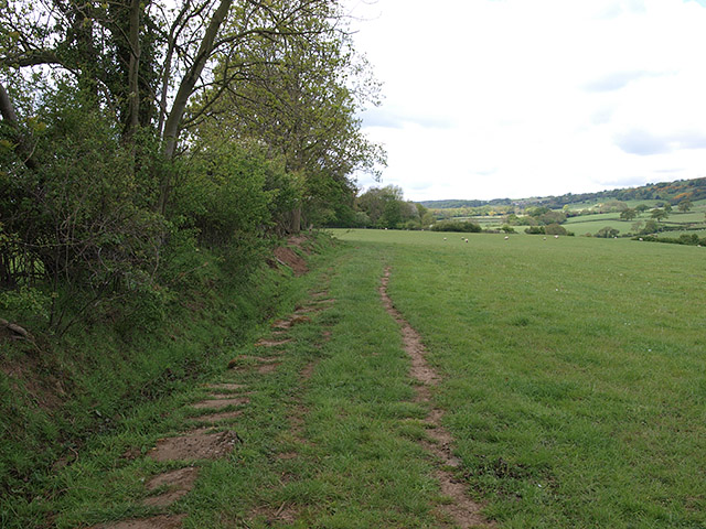
Bridleway approaching Hecks Wood. The rich variety of plants creates an ideal environment for wildlife; many bird species make their home along the water, with dippers often seen darting over the river and kingfishers and songbirds adding lively bursts of color and sound. In the clear waters, trout and salmon can be found, and the presence of dragonflies and damselflies highlights the healthy, vibrant ecosystem. Occasional sightings of otters and other small mammals further contribute to the charm of the walk.
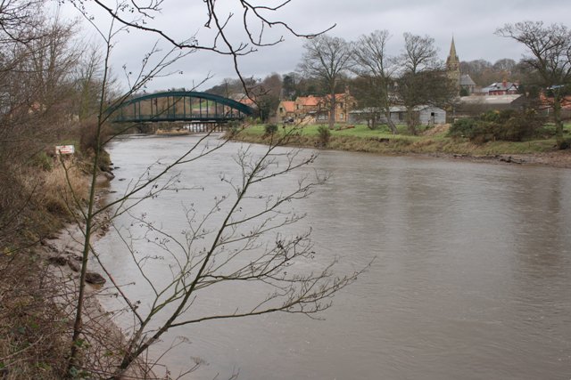
River Esk at Egton Bridge. The river runs for roughly 30 miles from its source high on the North York Moors, where fresh rainwater gathers and flows down steep slopes into deep wooded valleys. It winds its way through a diverse landscape, eventually reaching the North Sea near Whitby, offering not only a vital natural habitat but also scenic views and ample opportunities for outdoor recreation.
Elevation Profile


