Longridge Fell Walk
![]()
![]() Enjoy a walk to the summit of England's most southerley fell on this wonderful circular walk in the Forest of Bowland. The walk begins at the car park at Turner Fold and takes you to the 1,148-ft (350-m) summit on woodland footpaths. There are fabulous views from the high point including the Fylde Coast, the Vale of Chipping, the fells of the Forest of Bowland (including Parlick, Fair Snape Fell and Beacon Fell), the Yorkshire Dales and on a clear day the Lake District fells.
Enjoy a walk to the summit of England's most southerley fell on this wonderful circular walk in the Forest of Bowland. The walk begins at the car park at Turner Fold and takes you to the 1,148-ft (350-m) summit on woodland footpaths. There are fabulous views from the high point including the Fylde Coast, the Vale of Chipping, the fells of the Forest of Bowland (including Parlick, Fair Snape Fell and Beacon Fell), the Yorkshire Dales and on a clear day the Lake District fells.
Longridge Fell is situated to the north of both Preston and Blackburn.
The long distance Forest of Bowland Walk passes the fell. The circular route explores the AONB, visiting several of the highlights. It's a great way of extending your walking in this beautiful area.
The historical village of Ribchester lies at the foot of the fell. The village includes ruins of an old Roman Fort and nice riverside trails along the River Ribble.
You could also reach the fell by following trails from the nearby village of Chipping. The trails will take you to the fell via the River Hodder, approaching from the north west.
Postcode
BB7 9QY - Please note: Postcode may be approximate for some rural locationsLongridge Fell Ordnance Survey Map  - view and print off detailed OS map
Longridge Fell Open Street Map  - view and print off detailed map
Longridge Fell OS Map  - Mobile GPS OS Map with Location tracking
Longridge Fell Open Street Map  - Mobile GPS Map with Location tracking
Pubs/Cafes
Head south from the fell to Hurst Green and you could pay a visit to The Bayley Arms. The country pub does good food and has a nice outdoor seating area for warmer days. You can find the inn on Avenue Rd, Hurst Green, with a postcode of BB7 9QB for your sat navs.
The village is also a good start point for exploring the historic Stonyhurst College which dates back to the 16th century.
Dog Walking
The woodland trails on the fell are ideal for fit dogs. The Bayley Arms mentioned above is also dog friendly.
Further Information and Other Local Ideas
For a shorter walk you could start from the Jeffrey Hill car park located just to the south west of the fell at postcode PR3 2TT. You can then follow footpaths to the north east to climb to the Spire Hill summit.
A few miles to the west of the fell you'll find the popular Beacon Fell Country Park. There's more nice trails here with fantastic views back to Longridge from the high points. Near here there's also the peaceful and atmospheric Bleasdale Circle. This Bronze Age circular earthwork is thought to be aligned with the sunrise of the Summer Solstice. Brock Bottom is also in the vicinity and something of a hidden gem. Here you'll find a scenic picnic site next to the babbling River Brock. There's nice riverside trails and old mill ruins to see in this picturesque area. Calder Vale is just to the north of here and has a similar feel.
Only a mile south of the parking area you'll find the historic Stonyhurst College where J.R.R Tolkien worked on the Lord of the Rings novels during the second world war. Here you can pick up the Tolkien Trail which explores an area of the Ribble Valley thought to have inspired some of the landscapes from the books.
Cycle Routes and Walking Routes Nearby
Photos
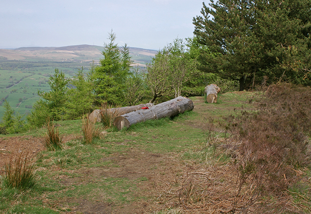
Viewpoint and seating area. The tree trunks have been provided as seating, wooden stakes driven into the ground to stop them rolling off downhill.


