Beacon Fell Country Park
![]()
![]() Explore 271 acres of woodland, moorland and farmland in the Forest of Bowland AONB. Beacon Fell is situated 266 metres (873 feet) above sea level giving fabulous views of Morecambe Bay, Blackpool Tower, Barrow, Pendle Hill, Longridge Fell, the Lake District Fells and the Isle of Man (on a clear day). At the hill summit there is a handy toposcope which shows all the different landmarks you can see.
Explore 271 acres of woodland, moorland and farmland in the Forest of Bowland AONB. Beacon Fell is situated 266 metres (873 feet) above sea level giving fabulous views of Morecambe Bay, Blackpool Tower, Barrow, Pendle Hill, Longridge Fell, the Lake District Fells and the Isle of Man (on a clear day). At the hill summit there is a handy toposcope which shows all the different landmarks you can see.
There are also several miles of lovely woodland walking trails, wooden sculptures, and a pretty tarn with a seating area at the eastern end. The excellent visitor centre includes with a wealth of information on the flora and fauna you can see on the fell. This includes bluebells in the spring and lovely heather in the autumn months.
Beacon Fell is situated a few miles north of Preston and not far from Lytham and Blackpool.
If you'd like to extend your walk you could head to the nearby Parlick and Fair Snape Fell where there is a wonderful footpath with fantastic views over the Forest of Bowland.
Beacon Fell Country Park Ordnance Survey Map  - view and print off detailed OS map
Beacon Fell Country Park Open Street Map  - view and print off detailed map
Beacon Fell Country Park OS Map  - Mobile GPS OS Map with Location tracking
Beacon Fell Country Park Open Street Map  - Mobile GPS Map with Location tracking
Pubs/Cafes
The visitor centre has a nice cafe where you can pick up some refreshments after your exercise. There's also a number of picnic benches on the grassy area just outside the cafe. It's a great place to sit outside and enjoy a snack while soaking in the views.
If you fancy a pub lunch then you could head to the nearby Cross Keys Inn in Whitechapel. The fine pub is located in a great place for Sunday Lunch. You can find them at Church Lane, Whitechapel with postcode PR3 2EP for sat navs.
Just to the west there's the village of Bilsborrow where you could visit the impressive Owd Nell's/Guy's Thatched Hamlet complex. The canalside 'village' includes a pub, restaurant, hotel and ice cream parlour. There's seats by the water and a nice surfaced towpath along this section of the Lancaster Canal. You can find them at postcode PR3 0RS.
Dog Walking
The park is excellent for dog walking with miles of woodland tracks to explore and off lead areas for them to roam. On a good day you're bound to bump into plenty of other people with their pets.
Further Information and Other Local Ideas
Just to the west of the park there's a bit of a hidden gem at Brock Bottom. Here you'll find a scenic picnic site next to the babbling River Brock. There's nice riverside trails and old mill ruins to see in this picturesque area. Just to the north of here there's also the village of Calder Vale which has a similar feel.
For more walking ideas in the area see the Forest of Bowland Walks page.
Cycle Routes and Walking Routes Nearby
Photos
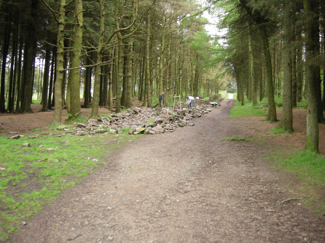
Woodland at Beacon Fell Country Park, Near Preston. This woodland is to the west of the visitor centre, on one of the tracks up toward the trig point.
A dog makes its way along a path in Shield Wood. This is one of the paths on Beacon Fell Country Park that have been made accessible for 'Trampers'. A Tramper is a 'low mobility all terrain vehicle' and, if needed,can be obtained from the visitor centre.


