Newquay to Perranporth Walk
![]()
![]() This is a popular coastal walk between Newquay and Perranporth along a section of the South West Coast Path. The walk is about 11 miles so it's perfect for a day's outing. It's a fantastic stretch of coast with lovely beaches, exhilirating cliff tops and beautiful bays. At Perranporth you can enjoy refreshments before catching the bus back to Newquay.
This is a popular coastal walk between Newquay and Perranporth along a section of the South West Coast Path. The walk is about 11 miles so it's perfect for a day's outing. It's a fantastic stretch of coast with lovely beaches, exhilirating cliff tops and beautiful bays. At Perranporth you can enjoy refreshments before catching the bus back to Newquay.
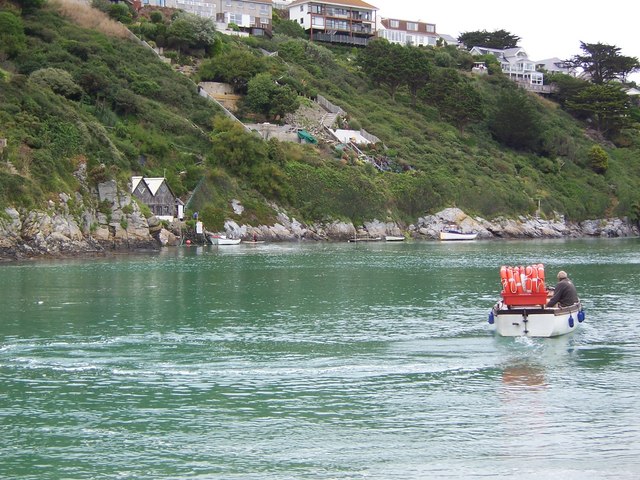
The walk starts off in the centre of the popular tourist town of Newquay, near to the train station and the bus station. You then follow the coast path through the town towards Towan Head where there are lovely views over the Newquay beaches. The path then heads along the popular surfing spot of Fistral Beach. You then cross the River Gannel to Crantock Sands which may require the use of the ferry at high tide. The route then visits Pentire Point and Kelsey Head before descending to the beautiful Holywell Beach which has a wonderful dune system and is managed by the National Trust. The route then rounds Penhale Point before crossing Penhale Sands which has the most extensive system of sand dunes in Cornwall. After crossing the sands you arrive at the pretty little town of Perranporth where you can enjoy a well earned drink at the UK's only bar on the beach.
To extend your walk you can continue along the coast path to St Agnes Head and enjoy a climb to St Agnes Beacon and a visit to the fascinating ruins of the Wheal Coates tin mine. See the Perranporth to St Agnes Walk for details of the route to the headland. Beyond there is the pretty village of Porthtowan. A few miles north of Newquay you can visit the Bedruthan Steps, a series of large photogenic rocks along the beach.
Newquay to Perranporth Ordnance Survey Map  - view and print off detailed OS map
Newquay to Perranporth Open Street Map  - view and print off detailed map
Newquay to Perranporth OS Map  - Mobile GPS OS Map with Location tracking
Newquay to Perranporth Open Street Map  - Mobile GPS Map with Location tracking
Pubs/Cafes
On the walk you could stop for refreshments at the Fernpit Cafe next to the ferry on the East Pentire Headland (Newquay side of the beach).
From the cafe there are great views over Crantock beach and the River Gannel.
It was built in the late 19th Century and has served as a tea garden for over 90 years. The cafe serves fresh crab sandwiches using crab caught and landed by our very own fishing boat Excelsior.
At the end of the route there's the splendidly located Watering Hole. The coastal pub is described as 'the UK’s only bar on the beach'. You can sit outside and enjoy fine coastal views with your meal here.
Further Information and Other Local Ideas
For an alternative circular walk from Newquay try the Newquay to Crantock Walk which takes you through Crantock village before returning to the town via Trevemper.
In Crantock you can also pick up the Holywell to Crantock Circular Walk to visit the lovely Holywell Bay and the secluded beach at Porth Joke.
To the north of Newquay there's Watergate Bay where you will find a wonderful 2 mile long surfind beach and a footbridge over to the splendid Porth Island headland.
For more walks in the county see the Cornwall Walks page.


