Baggeridge Country Park
![]()
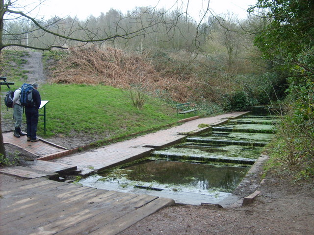
![]() Enjoy 150 acres of woodland and countryside in this country park near Wolverhampton. The park has four walking trails of varying levels of distance and difficulty. You will visit a number of peaceful water pools and viewpoints with terrific views of the surrounding countryside. There is also a two-mile figure of 8 mountain bike trail suitable for families with older children and beginners. Other attractions include a sensory garden, miniature railway and tea room. The park is located in Sedgley, just a few miles south of Wolverhampton city centre.
Enjoy 150 acres of woodland and countryside in this country park near Wolverhampton. The park has four walking trails of varying levels of distance and difficulty. You will visit a number of peaceful water pools and viewpoints with terrific views of the surrounding countryside. There is also a two-mile figure of 8 mountain bike trail suitable for families with older children and beginners. Other attractions include a sensory garden, miniature railway and tea room. The park is located in Sedgley, just a few miles south of Wolverhampton city centre.
On the southern side of the hall there's the 18th century Himley Hall. The historic hall is surrounded by ‘Capability’ Brown landscaped parkland with woodland walks, waterfalls and a large lake.
Postcode
DY3 4HB - Please note: Postcode may be approximate for some rural locationsPlease click here for more information
Baggeridge Country Park Ordnance Survey Map  - view and print off detailed OS map
Baggeridge Country Park Open Street Map  - view and print off detailed map
Baggeridge Country Park OS Map  - Mobile GPS OS Map with Location tracking
Baggeridge Country Park Open Street Map  - Mobile GPS Map with Location tracking
Pubs/Cafes
There's an on site cafe selling a decent range of meals and snacks.
Dog Walking
The park is a great place for dog walks so you'll probably see plenty of other dogs on your visit. The cafe mentioned above is also dog friendly and even serves special doggy ice cream!
Further Information and Other Local Ideas
Head a couple of miles west of the park and you can pick up the Staffordshire and Worcestershire Canal and enjoy a nice waterside walk along the towpath. You're also near to Wombourne where you can pick up the popular Wombourne Railway Walk and cycle or walk along the old railway line.
Head north from the park and you can try the Wolverhampton Canal Walk along the Birmingham Canal.
Also nearby is the circular Brewood Canal Walk. This visits the pretty Belvide Reservoir and the Georgian country house of Chillington Hall with its Capability Brown landscaped park and lake. The noteworthy Weston Park is also located just west of Belvide Reservoir and north west of Chillington Hall. There's more than 1000 acres of landscaped parkland surrounding this 17th century country mansion.
For more walking ideas in the area see the Staffordshire Walks page.
Cycle Routes and Walking Routes Nearby
Photos
The Toposcope, Baggeridge Country Park, with Baggeridge Brickworks. Situated on the old colliery tip, views in suitable weather include the Malvern Hills, The Wrekin and the Long Mynd. Baggeridge Brickworks still make a variety of special bricks. Brickmaking and collieries were often bedfellows as the shale brought up from the mines often crushes to good brickmaking clay.


