Parkland Walk
![]()
![]() This walk in London follows the course of an old railway line running between Finsbury Park and Alexandra Park. The whole route is actually a local nature reserve and is the longest of its type in London. With lots of flora and fauna to look out for on the way, it's a great place to enjoy an easy stroll in an urban environment. Keep your eyes peeled for wildlife including hedgehogs, foxes and also butterflies around the many wildflowers you can see on the route. In fact, more than three hundred species of wild flowers have been recorded on the Parkland Walk.
This walk in London follows the course of an old railway line running between Finsbury Park and Alexandra Park. The whole route is actually a local nature reserve and is the longest of its type in London. With lots of flora and fauna to look out for on the way, it's a great place to enjoy an easy stroll in an urban environment. Keep your eyes peeled for wildlife including hedgehogs, foxes and also butterflies around the many wildflowers you can see on the route. In fact, more than three hundred species of wild flowers have been recorded on the Parkland Walk.
The walk starts from the western end of Finsbury Park, just to the north of Finsbury Park station. You can enjoy a walk around the public park before you start. It contains a pretty lake, open ground, formal gardens, avenues of mature trees and an arboretum.
After leaving the park the route heads west to Crouch End. On this section look out for the old station master's house which still survives at road level. There are no longer any trace of the track or road-side station buildings, which were destroyed in a fire in 1967. You can also visit Crouch Hill Park and look out for the old platforms of Crouch End Station which are still visible, though somewhat overgrown.
The route then continues on nice woodland trails through Queen's Wood and Highgate Wood. The final section takes you through Muswell Hill to Alexandra Park before finishing at Alexandra Palace. The park is also a nice place to extend your exercise. It includes a boating lake, a Victorian style greenhouse, a deer enclosure with a small herd of fallow deer and a 10 hole pitch and putt golf course.
Postcode
N4 2NQ - Please note: Postcode may be approximate for some rural locationsPlease click here for more information
Parkland Walk Ordnance Survey Map  - view and print off detailed OS map
Parkland Walk Open Street Map  - view and print off detailed map
Parkland Walk OS Map  - Mobile GPS OS Map with Location tracking
Parkland Walk Open Street Map  - Mobile GPS Map with Location tracking
Pubs/Cafes
Refreshment options include the Finsbury Park Cafe at the start of the route. There's an extensive menu and a nice outdoor seating area with good views across the park.
At the other end of the walk there's the Phoenix Bar & Kitchen at Alexandra Park. There's outdoor seating overlooking the capital or inside the beautiful Palm Court. There's also a lakeside cafe which is a great place to relax on warmer days. The cafe has a good menu and also displays paintings by local artists.
Dog Walking
The walk is ideal for dog walking with nice woodland and parkland to explore.
Further Information and Other Local Ideas
Much of the route follows the Capital Ring long distance trail. You can extend your walk by continuing along the trail. Heading west will take you through East Finchley to Hampstead Garden Suburb where you can join up with the Dollis Valley Green Walk.
Just to the south of the route around Highgate you will find Hampstead Heath where you can enjoy more nice walking trails and a climb to Parliament Hill. The Finsbury Park Railway Walk uses part of the trail before heading to the heath.
Just to the east of Finsbury Park at the start of the route you will find the Woodberry Wetlands. This new nature reserve was created in 2016 and is a nice place to continue your walk. There's two pretty reservoirs, a boardwalk, and a visitors' centre with a cafe. It's a great place to see several species of water loving bird such as pochard, shoveler, gadwall, grey heron, tufted duck and reed bunting. You can also pick up the New River Path here and enjoy waterside paths along the River Lea.
Cycle Routes and Walking Routes Nearby
Photos
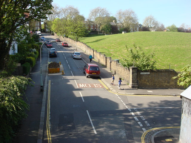
View from the walk at Crouch Hill. Seen from the top of a former Great Northern Railway bridge that is now part of the route.


