Lyke Wake Walk
![]()
![]() The Lyke Wake Walk is a complete crossing of the North Yorkshire Moors from west to east. It runs from Osmotherley, in the west, to Ravenscar, on the eastern coast of Yorkshire.
The Lyke Wake Walk is a complete crossing of the North Yorkshire Moors from west to east. It runs from Osmotherley, in the west, to Ravenscar, on the eastern coast of Yorkshire.
The Lyke Wake Walk challenge involves completing the 40 mile route in under 24 hours. It's a challenging walk done over any period of time as there are several steep ascents and some tricky sections across areas of peat bog. However, there is lots of beautiful moorland scenery and spectacular views from the high points which reach a peak of almost 1500ft at Bolton Head.
The walk starts at the northern end of Cod Beck Reservoir where there is a car park. You then head east along the Cleveland Way, passing Carlton Bank, Carlton in Cleveland and Cringle Moor where you can visit Lord Stones Country Park and the Wainstones. These fascinating sandstone rocky outcrops include a number of interesting Bronze Age carvings.
The route continues across Urra Moor, Greenhow Moor, Farndale Moor and High Blakely Moor. Much of this section follows a dismantled railway.
The next section takes you across Danby High Moor and past the beautiful valley of Rosedale and Rosedale Moor.
You continue across Wheeldale Moor to High Moor, crossing the North York Moors Railway as you go.
The final section takes you across Jugger Howe moor and Fylingdales Moor to the finish point at Ravenscar.
Please click here for more information
Lyke Wake Walk Ordnance Survey Map  - view and print off detailed OS map
Lyke Wake Walk Open Street Map  - view and print off detailed map
Lyke Wake Walk OS Map  - Mobile GPS OS Map with Location tracking
Lyke Wake Walk Open Street Map  - Mobile GPS Map with Location tracking
Pubs/Cafes
As you cross Blakey Moor on the noteworthy Blakey Ridge you will pass The Lion Inn. The elevated inn is one of the most significant pubs in the country and well worth some investigation. The historic pub dates from the 16th century and is located at the highest point on the North York Moors. It stands at an impressive elevation of 1,325 feet offering breathtaking views over the valleys of Rosedale and Farndale. There's a cosy interior with ancient fireplaces, low beamed ceilings and a good selection of ales. Outside there's a beer garden with terrific views, ideal for a warm summer day. The pub is also dog friendly. It's a great place to stop on the route if only to pop your head in for a quick drink. You can find the pub at postcode YO62 7LQ for your sat navs.
Cycle Routes and Walking Routes Nearby
Photos
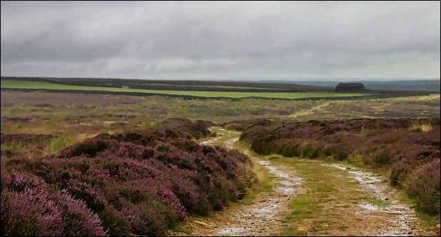
Field Barn on Hamer Moor. Windswept high moorland close to the Lyke Wake Walk. Hamer Moor between Rosedale and Glaisdale.


