The Ridgeway
![]()
![]() Step back in time on this wonderful 85 mile route which follows an ancient chalk ridge route used by prehistoric man.
Step back in time on this wonderful 85 mile route which follows an ancient chalk ridge route used by prehistoric man.
The trail starts at Overton Hill in Wiltshire on the edge of the Marlborough Downs and heads east through the Chiltern Hills to Ivinghoe Beacon in Buckinghamshire.
Highlights on this fascinating route include a series of iron age forts, the famous Uffington White Horse, the beautiful Chiltern Hills and a lovely stretch along the River Thames at Goring-on-Thames.
The Ridgeway Ordnance Survey Map  - view and print off detailed OS map
The Ridgeway Open Street Map  - view and print off detailed map
The Ridgeway OS Map  - Mobile GPS OS Map with Location tracking
The Ridgeway Open Street Map  - Mobile GPS Map with Location tracking
Pubs/Cafes
Near Coombe Hill in Wendover you'll pass The Russell Arms at Butler's Cross. The historic pub was originally an 18th century coach house. Its name dates back to the family that once owned Chequers (approximately 1 mile away) and the pub itself was where many of the staff that worked at Chequers lived. The inn has an extensive menu and a nice outdoor seating area for warmer days. You can find it about 100 metres north of Coombe Hill at 2 Chalkshire Road, Butlers Cross with a postcode of HP17 0TS for your sat navs. The pub is very dog friendly too and will provide water and biscuits.
The little village of Broad Hinton is located just off the trail near the Hackpen White Horse at Hackpen Hill. Here you can visit The Crown pub. They do excellent food and also have a lovely large garden area with fabulous views. Inside is very attractive too with a cosy fire for the winter. You can find them at a postcode of SN4 9PA.
Cycle Routes and Walking Routes Nearby
Photos
Video
Route Highlights
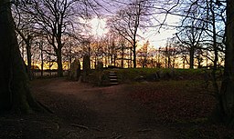
Overton HillStart of the route at Overton Hill in Wiltshire. It is the site of a wooden circle known as The Sanctuary indicating human activity for thousands of years |
Barbury CastleThis Iron Age hill fort is one of several forts found along the Ridgeway route. The site was first occupied some 2500 years ago, and was then in use during the Roman occupation of the area. |
Wayland's SmithyWayland's Smithy is a Neolithic long barrow and chamber tomb site dating back to 3700 BC. |
Liddington Castle HillLate Bronze Age and early Iron Age hill fort. Liddington Castle was one of the earliest hill forts in Britain, with first occupation dating to the seventh century BC |
BishopstonePicturesque village just off the trail with two pubs and a large number of thatched cottages, centred around a mill-pond. |
Uffington White HorseThis National Trust owned site is home to a highly stylised prehistoric hill figure, 374 feet (110 m) long, formed from deep trenches filled with crushed white chalk. It is approximately 3000 years old |
StreatleyThe trail passes right through this attractive village situated on the River Thames |
Segsbury CampIron Age hill fort situated on the Berkshire Downs, near the Ridgeway above Wantage. The periodic occupation of the hill fort between the 6th and 2nd centuries BC suggests that it was a communal centre for various activities, including sheep management and exchange. The circular Letcombe Regis Walk visits the camp from the village, located north of the trail here. There's also an 18th century pub and pretty local nature reserve to visit in the village. |
Aston Rowant Nature ReserveThis lovely Nature Reserve is located in the Chilterns Area of Oustanding Natural Beauty. Aston Rowant is especially noted in Spring and Summer for the wildflowers and orchids associated with close-cropped chalk grassland. |
Princes RisboroughThis small town is just off the route and makes and ideal stopping place for refreshments or an overnight stay. |
ChequersThe country residence of the Prime Minister of the United Kingdom |
WallingfordkSituated just off the route the market town of Wallingford sits on the River Thames. It boasts a 12th century medieval road bridge spanning the Thames to Crowmarsh Gifford. Handy for stopovers with plenty of accommodation options. |
Coombe HillThe highest point in the Chilterns with a distinctive monument to the Second Boer War. There are fabulous views across the Vale of Aylesbury and the Cotswolds. |
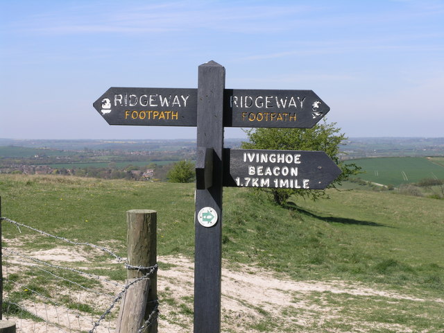
Ivinghoe beaconThis 233 m (757 ft) hill marks the end of the trail. |


