Brent Reservoir
![]()
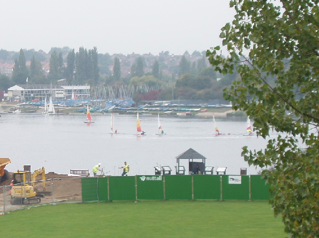
![]() Brent Reservoir and the Wesh Harp Open space space is a popular place for walkers and cyclists. A traffic free path runs long the northern shore of this large lake with views across the water and woodland trails. It's a fine place for bird watching with two bird hides and visitors which include great crested grebe, gadwall, shoveler, common pochard, tufted duck and common tern. There's also the Welsh Harp Environmental Education Centre which is a 15 acre woodland site where children can have a hands-on experience with nature.
Brent Reservoir and the Wesh Harp Open space space is a popular place for walkers and cyclists. A traffic free path runs long the northern shore of this large lake with views across the water and woodland trails. It's a fine place for bird watching with two bird hides and visitors which include great crested grebe, gadwall, shoveler, common pochard, tufted duck and common tern. There's also the Welsh Harp Environmental Education Centre which is a 15 acre woodland site where children can have a hands-on experience with nature.
If you'd like to extend your walk you could pick up the Capital Ring walking route and follow it west to the nearby Fryent Country Park.
Postcode
NW9 8RY - Please note: Postcode may be approximate for some rural locationsBrent Reservoir Ordnance Survey Map  - view and print off detailed OS map
Brent Reservoir Open Street Map  - view and print off detailed map
Brent Reservoir OS Map  - Mobile GPS OS Map with Location tracking
Brent Reservoir Open Street Map  - Mobile GPS Map with Location tracking
Pubs/Cafes
The George is located just to the north west of the reservoir. They serve good food and have a nice garden area for warmer weather. You can find them a short stroll from the site at 234 Church Lane with a postcode of NW9 8SN for your sat navs.
Dog Walking
The open space and reservoir are a nice place for a dog walk so you'll probably see other owners on your visit. There's some good woodland and parkland trails in the nearby Fryent Country Park. These are very popular with dog walkers too. The George pub mentioned above is also dog friendly.
Further Information and Other Local Ideas
Just to the east you can pick up the Dollis Valley Green Walk in Hendon. The pleasant route will take you through London along the Dollis Brook, where there's lots of interesting flora and fauna to see.
For more walking ideas in the area see the London Walks page.
Cycle Routes and Walking Routes Nearby
Photos
A lovely summer view of the lake in 2007. The reservoir was created by the construction of a dam across the River Brent which was built between 1833 and 1835, and extended in 1854, in order to provide water for the Paddington Arm of the Grand Union Canal. The Grand Union Canal, and their successors, British Waterways, owned or own the reservoir, which has also been known as the Kingsbury Reservoir and the Welsh Harp Reservoir in the past. This is the northern section, viewed from Cool Oak Bridge, and is fed by the Silk Stream.
Cool Oak Bridge at the site. The bridge was built to take Cool Oak Lane over the northern extension of the reservoir. Nowadays it has traffic light management and a vehicle weight restriction.
River Brent at Brent Cross. The Ordnance Survey 1:50,000 scale mapping shows a sea of dark green here as the A406 North Circular Road and the A41 Hendon Way meet at the Brent Cross Flyover, so you'll have to take my word for it that this is where the river is too. A small weir impounds a head of water as the river flows down towards the reservoir.


