Hurn Forest
![]()
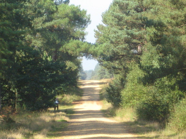
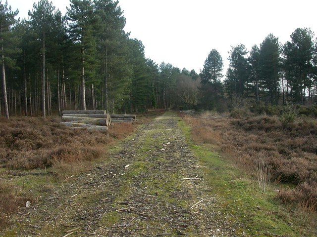
![]() Enjoy a cycle or walk through this pleasant area of woodland near Bournemouth. There are miles of good tracks to explore the area which includes woodland, heathland and ponds. The Moors River also runs past the western edge of the wood where you will also be able to see Bournemouth Airport.
Enjoy a cycle or walk through this pleasant area of woodland near Bournemouth. There are miles of good tracks to explore the area which includes woodland, heathland and ponds. The Moors River also runs past the western edge of the wood where you will also be able to see Bournemouth Airport.
There is a parking area on Matchams Lane from which this route starts. You can see this on the street view link below.
To extend your outing head to the nearby Avon Heath Country Park near Ringwood.
Parley Common is also only a mile to the west in Ferndown where you can pick up the circular Ferndown, Stour and Forest Trail. The pleasant route explores Ferndown Forest and the wildlife rich Holt Heath National Nature Reserve. The popular Castleman Trailway can also be picked up here and followed along a disused railway line to Ringwood or Poole.
Postcode
BH23 6AW - Please note: Postcode may be approximate for some rural locationsHurn Forest Ordnance Survey Map  - view and print off detailed OS map
Hurn Forest Open Street Map  - view and print off detailed map
Hurn Forest OS Map  - Mobile GPS OS Map with Location tracking
Hurn Forest Open Street Map  - Mobile GPS Map with Location tracking
Explore the Area with Google Street View 
Further Information and Other Local Ideas
The Sopley Common Nature Reserve and the Ramsdown Forest Plantation are located just a short distance south of the forest. The reserve includes dry and wet heath and is teeming with rare wildlife. The adjacent Ramsdown Forest includes a fine viewpoint with views over Hurn Airport and the forest. A little further to the south there's another viewpoint at St Catherine's Hill on the outskirts of Christchurch.
Also nearby is the town of Verwood. Here you can enjoy a walk around Verwood Forest, the Cranborne Common Nature Reserve and the Stephen's Castle Nature Reserve where there's a lovely viewpoint.
For more walking ideas in the area see the Dorset Walks page.
Cycle Routes and Walking Routes Nearby
Photos
Matchams Lane plantation. Forestry Commission-owned plantation, showing how in this area trees were planted on the crest of ridges.
Path to the Ramsdown viewpoint - located just south of the forest. This flat-topped sandy hill is now surrounded by a wooden rail fence, presumably to discourage access by any route other than the recently constructed steps. The area to the right is a nature reserve managed by the HCT. The two people on the bench at the end of the path are admiring the view, across Ramsdown Plantation and across to Bournemouth International Airport and Hurn Forest.
Sopley Common. The view across the southeastern part of Town Common - the bridge that carries the Avon Causeway road across the A338 Bournemouth spur road can be seen in the distance. The common is located just south of the forest and is covered in pretty heather in the late summer months.
Path along the northern edge of Ramsdown Plantation. The path stretching off into the distance follows the northern edge of Ramsdown Plantation, with the southern edge of Sopley Common (the part annexed by the Avon Causeway road) to the right of the wire fence. The wooden rail fence in the foreground surrounds a bronze age round barrow, from which this photo was taken.


