GPS Cycle and Walking Routescycle iconwalk icon

Pontypool to Blaenavon Cycle Route

11.8 miles (19 km)

Ordnance Survey Map Open Streetmap This route follows National Cycle Network Route 492 from Pontypool to Blaenavon via Abersychan.
The ride follows a dismantled railway north from the town of Pontypool to the Blaenavon World Heritage Site. It's a traffic free ride with some pleasant woodland and fine views of the Afon Llwyd valley.
The route runs for about 12 miles and is slightly uphill going from Pontypool to Blaenavon.
Route highlights include the interesting Big Pit National Mine Museum and the Blaenavon World Heritage site at the end of the route. Here you'll find a heritage steam railway and an industrial museum where you can learn all about the Welsh heritage of coal mining through a multi-media tour of a modern coal mine.

Pontypool to Blaenavon OS Map Ordnance survey map - Mobile GPS OS Map with Location tracking

Pontypool to Blaenavon Open Street Map Open Streetmap - Mobile GPS Map with Location tracking

Cycle Routes and Walking Routes Nearby

Photos

Site of former Cwmffrwdoer Halt on NCN Route 46 - geograph.org.uk - 2649347

Site of former Cwmffrwdoer Halt

Cycleway, Pen-twyn - geograph.org.uk - 399288

Cycleway, Pen-twyn

Cycleway, above Abersychan - geograph.org.uk - 399341

Cycleway, above Abersychan

20191020 Former Goods Shed of Abersychan and Talywain Station

Former Goods Shed of Abersychan and Talywain Station

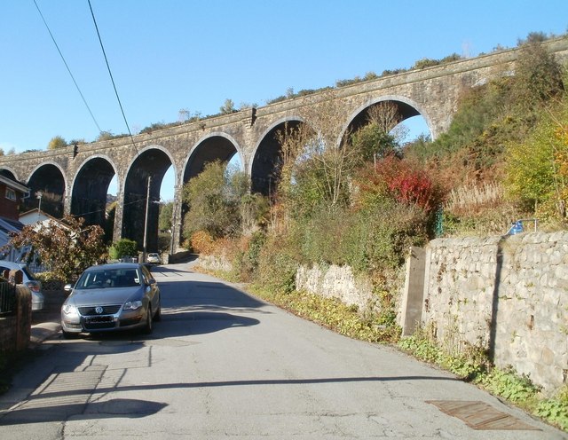
Garndiffaith Viaduct crosses Viaduct Road (geograph 2137517)

Garndiffaith Viaduct crosses Viaduct Road

NCN492 passing former Cwmavon railway station (geograph 7016071)

NCN492 passing former Cwmavon railway station

NCN Route  near Blaenavon - geograph.org.uk - 2649300

NCN Route near Blaenavon

Pontypool and Blaenavon Railway - geograph.org.uk - 579069

Pontypool and Blaenavon Railway

GPS Files

GPX File

Pontypool to Blaenavon.gpx (On Desktop:Right Click>Save As. On Ipad/Iphone:Click and hold>Download Linked File)