Symonds Yat River Circular Walk
![]()
![]() Enjoy wonderful views over the Wye Valley from this well known viewpoint on the Herefordshire and Gloucestershire border. From the elevated position you have a great view of the beautiful wooded gorge below. It's also a popular spot for birdwatching with peregrine falcons, buzzards, goshawks and hobbies regularly seen. The area is great for walking and cycling with miles of waymarked woodland trails and riverside paths to try. This circular walk starts from the car park and follows good footpaths to the viewpoint. You then continue along the river through the woodland, passing Huntsham Hill on the way. A section along the Perigrine Path then takes you along the River Wye before heading through Riddings Wood to the car park.
Enjoy wonderful views over the Wye Valley from this well known viewpoint on the Herefordshire and Gloucestershire border. From the elevated position you have a great view of the beautiful wooded gorge below. It's also a popular spot for birdwatching with peregrine falcons, buzzards, goshawks and hobbies regularly seen. The area is great for walking and cycling with miles of waymarked woodland trails and riverside paths to try. This circular walk starts from the car park and follows good footpaths to the viewpoint. You then continue along the river through the woodland, passing Huntsham Hill on the way. A section along the Perigrine Path then takes you along the River Wye before heading through Riddings Wood to the car park.
There are several other waymarked trails in the area which visit the Iron Age Hillfort and Mailscot Wood. There is also a nature trail with nature boards through an attractive section of mixed woodland. You can buy refreshments from the excellent Log cabin cafe.
This route is designed for walkers but cyclists can try the Symonds Yat Rock Cycle Trail which runs for about 3 miles from the campsite. You can also pick up the Perigrine Path cycle route which runs through Symonds Yat.
If you would like to extend your walk then you can continue along the river using the Wye Valley Walk. If you head west you can visit the mysterious King Arthur's Cave and then cross the England-Wales border and arrive at Monmouth where you can visit the splendid Kymin Hill for more wonderful views over the area. You can reach the rock from Monmouth by following the 8 mile Monmouth to Symonds Yat Walk.
If you head east you'll soon come to Lower Lydbrook and the ruinous Norman medieval Goodrich Castle. Here you can climb Coppet Hill for more great views into Wales.
Postcode
GL16 7EL - Please note: Postcode may be approximate for some rural locationsSymonds Yat Rock Ordnance Survey Map  - view and print off detailed OS map
Symonds Yat Rock Open Street Map  - view and print off detailed map
*New* - Walks and Cycle Routes Near Me Map - Waymarked Routes and Mountain Bike Trails>>
Symonds Yat Rock OS Map  - Mobile GPS OS Map with Location tracking
Symonds Yat Rock Open Street Map  - Mobile GPS Map with Location tracking
Pubs/Cafes
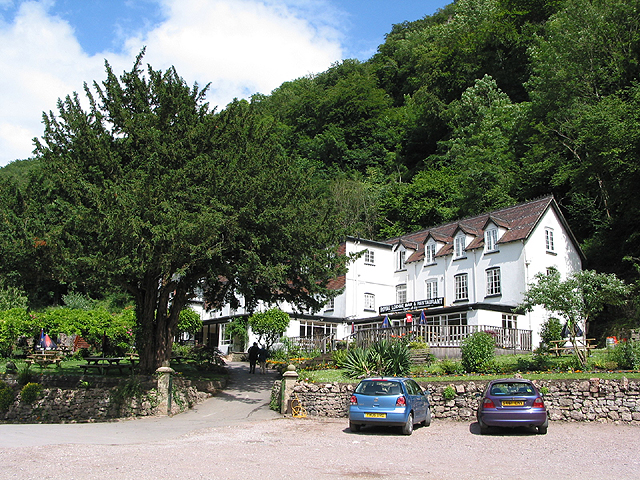
There are some charming old pubs on both sides of the river. In Symonds Yat East you can head to the splendid Saracens Head Inn for some post walk refreshments. The family run inn is popular with walkers, cyclists, canoeists, fishermen and fans of good food and real ales. It has stood for centuries in a spectacular position on the east bank of the River Wye, where the river flows into a steep wooded gorge, on the edge of the Forest of Dean. In good weather you can sit outside and watch the ancient hand ferry from one of the riverside terraces. There's a good hot food menu and they also serve sandwiches and filled organic baguettes during lunchtimes. They also provide accommodation if you need to stay over. You can find it in the village with a postcode of HR9 6JL for your sat navs.
If you cross the river on the ferry to Symonds Yat West you could visit the noteworthy Ye Old Ferrie Inn. The beautiful riverside pub has been standing on the banks of the River Wye since 1473. With charming traditional features, warming open fires and stunning views across the Valley, it is the ideal place to enjoy the breath-taking countryside that surrounds it. The outdoor seatiing area directly overlooks the river so is perfect for fine summer days. You can find it on Ferrie Lane with a postcode of HR9 6BL.
Dog Walking
The woods around Symonds Yat are a great place for dog walking with miles of good trails to try. The Saracens Head and Ye Old Ferrie Inn pubs mentioned above are also dog friendly.
Further Information and Other Local Ideas
A few miles to the south you could visit the interesting village of St Briavels. Here you will find the historic St Briavels Castle which dates back to the 12th century and is open to the public under the care of English Heritage. The village can be accessed by crossing the Bigsweir Bridge over the Wye from Llandogo in Wales to St Briavels in England on the other side. In Llandogo you can enjoy a walk to the pretty Cleddon Falls on the River Cleddon.
Near here there's Brockweir where there is easy access to the historic ruins of Tintern Abbey and Tintern Old Station, where you can learn all about the history of the local railway.
For more walking ideas in the area see the Wye Valley Walks page.
Cycle Routes and Walking Routes Nearby
Photos
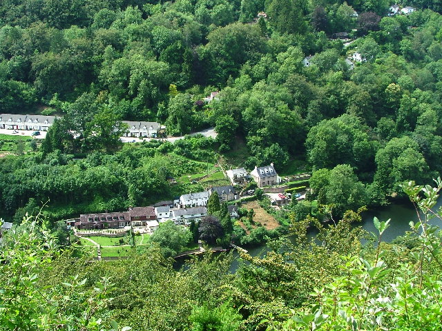
Looking north east from the viewpoint at Symonds Yat rock, around which runs the incised meander of the river Wye valley.


