Ambleside to Skelwith Bridge Walk
![]()
![]() This is a lovely walk taking you from the popular town of Ambleside to Skelwith Bridge via Loughrigg Tarn. It's a fairly easy route, running for just under 4 miles with some moderate climbs.
This is a lovely walk taking you from the popular town of Ambleside to Skelwith Bridge via Loughrigg Tarn. It's a fairly easy route, running for just under 4 miles with some moderate climbs.
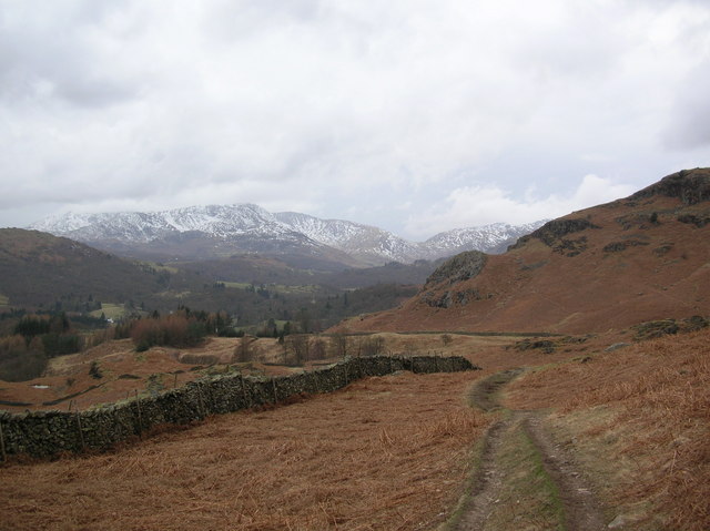
Starting in Ambleside head west through Rothay Park before climbing to Miller Brow and Deer Hows. There's great views back down to Ambleside and Windermere Lake from the high points around here.
The route then descends to Ivy Crag before another short climb up to Loughrigg Tarn. It's a delightfully peaceful spot with the tranquil waters of the tarn surrounded by some beautiful countryside.
After rounding the tarn you descend to Neaum Crag and then to Skelwith Bridge where you can visit Skelwith Force waterfall. The impressive falls are located on the River Brathay and include a viewing area where you can get close up to the rushing water.
Near here there's a nice riverside cafe where you can enjoy refreshments after your walk. Across the road there's also the Skelwith Bridge Hotel. From here you can pick up the bus back to Ambleside.
To extend your walking in the area you can pick up the Cumbria Way and head west to visit Colwith Force waterfall. The falls drop 40 feet over several stages and are a spectacular sight when in full spate.
Ambleside to Skelwith Bridge Ordnance Survey Map  - view and print off detailed OS map
Ambleside to Skelwith Bridge Open Street Map  - view and print off detailed map
Ambleside to Skelwith Bridge OS Map  - Mobile GPS OS Map with Location tracking
Ambleside to Skelwith Bridge Open Street Map  - Mobile GPS Map with Location tracking
Pubs/Cafes
At the end of the walk at Skelwith Bridge you can enjoy refreshments at the lovely Chesters by the River cafe. Here you'll find a nice riverside deck where you can sit outside and enjoy lunch on finer days. There's delicious salads, specials, cakes and a shop where you can buy souvenirs. You can find it at postcode LA22 9NW for your sat navs.


