Athlone Walks - River Walk
![]() This town in central Ireland includes an historic castle, pretty local parks and nice walks along the River Shannon.
This town in central Ireland includes an historic castle, pretty local parks and nice walks along the River Shannon.
This walk in the town takes you along the River Shannon to visit Burgess Park on the eastern side of the river.
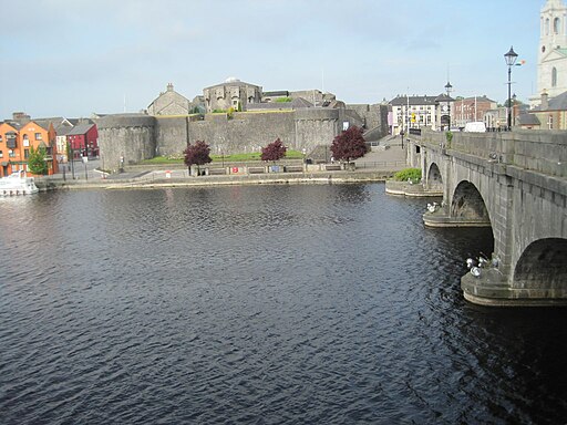
You can start the walk from the medieval castle where there are some fine views over the town from the battlements. You can then cross the Shannon Road Bridge where there are lovely views along the river.
On the other side head south and the riverside path will take you to Burgess Park. The park is a fine place for a stroll with good surfaced paths taking you to a memorial garden, playground, and recreational areas.
To continue your walking around Athlone head north to pick up the Lough Ree Park Walking Trail. There's some lovely views across the expansive lough from this pretty waterside park.
Athlone Open Street Map  - view and print off detailed map
Ireland Walking Map - View All the Routes in the Country>>
Athlone Open Street Map  - Mobile GPS Map with Location tracking
Walks near Athlone
Further Information and Other Local Ideas
The Athlone - Mullingar Greenway starts in the town. The shared cycling and walking trail will take you along the old railway line to Mullingar via Moate.
On the eastern side of Lough Ree there's the Corlea Trackway. Here you will find the fascinating Corlea Trackway Visitor Centre, which houses an 18-meter stretch of a preserved Iron Age roadway, constructed in 148 BC from heavy oak planks.
In Longford you can pick up the Longford Canal Branch of the Royal Canal and enjoy an easy waterside walk. The peaceful woodland trails in Newcastle Wood can also be found in this area.
Photos
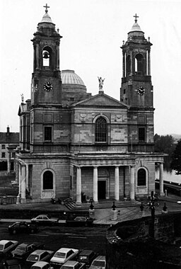
River Shannon. Roscommon is on the left bank, Westmeath on the right. St Peter and Pauls Cathedral can be seen in the distance.


