GPS Cycle and Walking Routescycle iconwalk icon

Balmacara Estate and Loch Alsh Walk

4.3 miles (7 km)

Ordnance Survey Map Open Streetmap Explore 6,330 acres of farmland, woodland, moorland, coastline, saltmarsh, lochs and offshore islands on this stunning National Trust run estate.
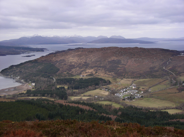
The circular walk takes you through peaceful woodland to pretty lochside beaches with stunning views across Loch Alsh to the mountains of Skye and Applecross.
The path is well defined/waymarked and involves some climbing through the woodland.
You can extend the walk by visiting Ard Hill, Kirkton Hill or the nearby Loch Achaidh na H-inch and Loch Lundie.

Balmacara Estate OS Map Ordnance survey map - Mobile GPS OS Map with Location tracking

Balmacara Estate Open Street Map Open Streetmap - Mobile GPS Map with Location tracking

Cycle Routes and Walking Routes Nearby

Photos

Balmacara House - geograph.org.uk - 2111055

Balmacara House

The start of the Lochalsh Woodland Walk - geograph.org.uk - 4974296

The start of the Lochalsh Woodland Walk

Pool at Balmacara Square - geograph.org.uk - 2984679

Pool at Balmacara Square

The view west from the summit of Sgurr Mor - geograph.org.uk - 433451

The view west from the summit of Sgurr Mor

GPS Files

GPX File

Balmacara Estate.gpx (On Desktop:Right Click>Save As. On Ipad/Iphone:Click and hold>Download Linked File)

Memory Map Route

Balmacara Estate.mmo (On Desktop:Right Click>Save As. On Ipad/Iphone:Click and hold >Download Linked File)