Bamford Edge Walk
![]()
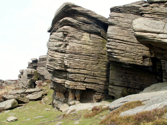
![]() Climb to Bamford Edge on this exhilarating walk in the Peak District. The walk is geologically significant with lots of interesting gritstone rock formations to look out for. From the elevated position of Bamford Edge there are simply wonderful views over the surrounding area.
Climb to Bamford Edge on this exhilarating walk in the Peak District. The walk is geologically significant with lots of interesting gritstone rock formations to look out for. From the elevated position of Bamford Edge there are simply wonderful views over the surrounding area.
The walk starts from the Derbyshire village of Bamford and climbs on country lanes towards Bole Hill and Bamford Clough. You then head north and pick up the Bamford Edge footpath on Bamford Moor. There are splendid views across the Peak District Hope Valley and down to the lovely Ladybower Reservoir below.
The route can be turned into a longer circular walk by continuing to Stanage Edge just east of Bamford Edge. Here you will find a stunning gritstone escarpment of Stanage Edge and the peak of High Neb. From here you can enjoy wonderful views over the Hallam Moors and the Hope Valley.
You could also descend to Ladybower Reservoir and enjoy the woodland trails along the water.
The Derwent Valley Heritage Way runs past Bamford so this is another option. You could follow the riverside path into Hathersage for example. The walk could also be started from Hathersage following the River Derwent to Bamford and then ascending from there.
Just to the west you can enjoy a climb to Win Hill which has some of the best views in the area.
Postcode
S33 0BQ - Please note: Postcode may be approximate for some rural locationsBamford Edge Ordnance Survey Map  - view and print off detailed OS map
Bamford Edge Open Street Map  - view and print off detailed map
*New* - Walks and Cycle Routes Near Me Map - Waymarked Routes and Mountain Bike Trails>>
Bamford Edge OS Map  - Mobile GPS OS Map with Location tracking
Bamford Edge Open Street Map  - Mobile GPS Map with Location tracking
Pubs/Cafes
The Angler's Rest in Bamford village is a fine place to go for some post walk refreshments. The community-owned pub and cafe includes facilities such as a post office, log burner, beer garden, large car park and secure bike racks. In the bar area there's a fine selection of real ales, while the cafe offers light meals, delicious cakes baked on the premises, as well as hot and cold drinks. The cafe also hosts a nice art gallery with a monthly exhibition of original work by local artists that not only brightens the walls but is also available to buy. It's a great place to go because you are not just enjoying a pint, a coffee or buying a stamp, you are also helping to sustain a community! You can easiliy find the pub on the Main Road in Bamford with a postcode of S33 0DY for your sat navs.
Also in the village you will find the Yorkshire Bridge Inn. This fine inn was awarded the Gold Award in the East Midlands Tourism Enjoy England Excellence Award 2009. There's an excellent menu and they also provide good quality accommodation if you need to stay over. Outside there's a lovely beer garden to relax in when the weather is good. You can find the pub on Ashopton Road with a postcode of S33 0AZ.
Dog Walking
The Edge is a nice place to take your dog but there are some restrictions. They are still allowed on public rights of way, but not on the access land to the sides or on footpaths that are not designated as rights of way. Given that there are no rights of way that run under the crag, please do not take dogs climbing with you as this could damage the currently good relationship climbers enjoy with the landowner.
The Rest cafe mentioned above is dog friendly with water bowls provided outside for dogs.
Further Information and Other Local Ideas
Near Bamford you can pick up the Thornhill Trail. The shared cycling and walking trail runs along a disused railway line to the Ladybower Dam.
Cycle Routes and Walking Routes Nearby
Photos
Bamford Edge. The area is great for wildlife with a variety of bird species, including kestrels, buzzards, and red grouse, which are often seen soaring above the moorland. The edge’s rocky outcrops also provide habitats for smaller birds such as meadow pipits and wheatears. In spring and summer, the surrounding heathland bursts into life with vibrant heather and bilberry plants, attracting insects like bees and butterflies
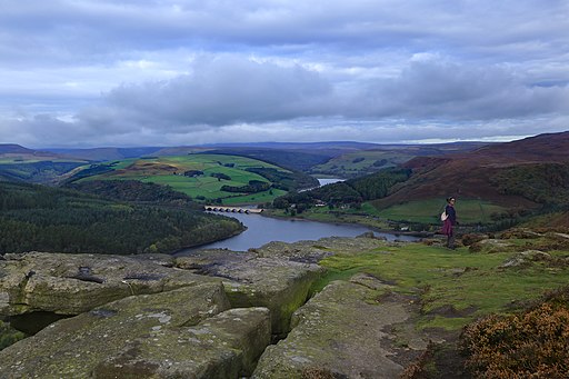
Ladybower Reservoir in the Upper Derwent Valley, taken from the crags of Bamford Edge in the Derbyshire Peak District. The reservoir and surrounding woods further enhance the area’s ecological richness. The reservoir supports waterfowl such as mallards and Canada geese, while the woodlands are alive with species like robins, blackbirds, and even occasional sightings of deer. If you’re lucky, you may spot a heron fishing along the reservoir's edges
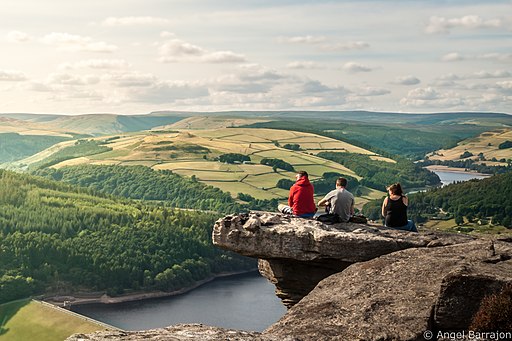
From the top of Bamford Edge, the views are expansive and breathtaking, offering a wide panorama of the Peak District. The most striking feature is the view over Ladybower Reservoir, with its iconic Y-shaped structure surrounded by woodland and rolling hills. On a clear day, you can also see the Ashopton Viaduct, which spans the reservoir, and the lush green landscape of the Hope Valley stretching into the distance.
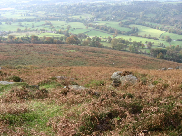
Looking further afield, the high peaks of the Kinder Scout Plateau and Mam Tor are visible, showcasing the rugged beauty of the Dark Peak area. The village of Bamford lies below, nestled amidst fields and trees, creating a picturesque foreground to the sweeping landscapes beyond.


