Barnsley Boundary Walk
![]()
![]() A super circular walk around the South Yorkshire town.
Walk highlights includes a series of lovely reservoirs, the beautiful Peak District scenery and the splendid Bretton Country Park. The country park includes 500 acres of lakes and parkland, housing various sculptures as well as being the home of several endangered species. The fascinating Yorkshire Sculpture Park also sits within the park and is well worth exploring. The only one of its kind, the park is an international centre for modern and contemporary art, which receives thousands of visitors each year.
A super circular walk around the South Yorkshire town.
Walk highlights includes a series of lovely reservoirs, the beautiful Peak District scenery and the splendid Bretton Country Park. The country park includes 500 acres of lakes and parkland, housing various sculptures as well as being the home of several endangered species. The fascinating Yorkshire Sculpture Park also sits within the park and is well worth exploring. The only one of its kind, the park is an international centre for modern and contemporary art, which receives thousands of visitors each year.
Also on the route is the interesting Elescar Heritage Centre. Set in the conservation village of Elsecar, the centre is located within the former ironworks and colliery workshops of the Earl Fitzwilliam. Restored historical buildings now house an antique centre, individual craft workshops, and exhibitions of Elsecar's past. In the village you can also visit Elsecar Reservoir and Canal.
Another major highlight is the delightful Cannon Hall Country Park. This country house museum is set in 70 acres of historic parkland and includes a collection of art including ceramics, glass, furniture and Old Master paintings, displayed in the hall's Georgian and Victorian room.
You'll also enjoy waterside sections along the beautiful Winscar Reservoir, Langsett Reservoir, Underbank Reservoir, Broadstone Reservoir, Scout Dike, Royd Moor and Ingbirchworth Reservoirs.
The walk is waymarked with a green and yellow square.
Barnsley Boundary Walk Ordnance Survey Map  - view and print off detailed OS map
Barnsley Boundary Walk Open Street Map  - view and print off detailed map
Barnsley Boundary Walk OS Map  - Mobile GPS OS Map with Location tracking
Barnsley Boundary Walk Open Street Map  - Mobile GPS Map with Location tracking
Pubs/Cafes
On the route you'll pass Old Moor where you'll find the Old Moor Tavern. It's a friendly pub with a good menu and an outdoor seating area. Right next to the pub you will also find the RSPB Dearne Valley. This 89-hectare wetlands nature reserve is a nice place to stroll around and look out for wildlife. You can find the pub on Everill Gate Lane with a postcode of S73 0YQ.
Cycle Routes and Walking Routes Nearby
Photos
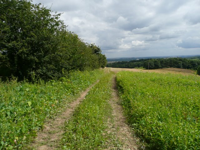
Broadstone Reservoir. The view from Birds Nest Lane on the Barnsley Boundary Walk. The skyline has lost the tall turbines of the Wind Farm on this hazy spring day.
Elevation Profile


