Battlesbury Hill
![]()
![]() This walk takes you to an ancient Hillfort and viepwoint in Warminster, Wiltshire.
This walk takes you to an ancient Hillfort and viepwoint in Warminster, Wiltshire.
There's decent footpaths leading up to the hill top from Sack Hill Road which lies just to the north of the site. Here you will find a hill fort dating to the Late Bronze Age & the Iron Age (800 BCE–200 BCE). You can walk around the ancient banks and ditches while enjoying a splendid view of the surrounding hills and countryside. The hill stands at a height of 208 metres so it is a reasonable climb to the top.
You can extend the walk by picking up the Imber Range Perimeter Path and following it south to visit Scratchbury Hill. The route could then be followed further around the MOD's area on Salisbury Plain.
Postcode
BA12 9DP - Please note: Postcode may be approximate for some rural locationsBattlesbury Hill Ordnance Survey Map  - view and print off detailed OS map
Battlesbury Hill Open Street Map  - view and print off detailed map
Battlesbury Hill OS Map  - Mobile GPS OS Map with Location tracking
Battlesbury Hill Open Street Map  - Mobile GPS Map with Location tracking
Further Information and Other Local Ideas
Head west and you can enjoy another climb to the popular viewpoint at Cley Hill. The waterside paths around Shearwater Lake can also be found near here.
Cycle Routes and Walking Routes Nearby
Photos
Dew pond, Battlesbury Hill. Dew ponds seen on the Wiltshire downs were mainly made in the 19th and 20th centuries. This one may have been made after the area started to be used for military training. The pond is the grassy area nearest the camera; the photo shows about half the area of the pond.
Ancient banks and ditches, Battlesbury Hill. Excavations and surveys at the site have uncovered various finds and archaeological evidence. Pits found within the fortifications contained late Iron Age pottery, the hub of a chariot wheel, an iron carpenter's saw, a latch-lifter for a hut door, querns, whetstones, sling stones, and animal bones. These all indicate a permanent occupation and date from the 1st century BC.
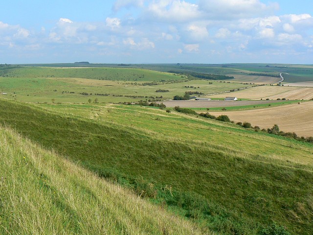
Imber range, near Norton Bavant, Wiltshire. The foreground shows the eastern earthwork of the hill fort atop Battlesbury Hill. The buildings just to the right of centre are in this square and are marked on the map as 'Field Barn' which is not a place name, just a generic term which is self-explanatory. The road winding away into the distance is the southern range road.
The Imber Range Path heads up Scratchbury Hill. Scratchbury Camp fort encompasses an area of 37 acres (15 hectares) and occupies the summit of a hill on the edge of Salisbury Plain, with its four-sided shape largely following the natural contours of the hill.
The Iron Age hillfort dates to around 100 BC and contains the remains of an earlier, smaller D-shaped enclosure or camp. The age of this earlier earthwork is currently debated, with interpretations varying due to the inconclusive and incomplete nature of previous excavation records. Some suggest it dates to the early Iron Age around 250 BC, while others propose it could be from the Bronze Age, around 2000 BC.
Within the fort, there are seven tumuli, which were excavated in the 19th century by Sir Richard Colt Hoare and William Cunnington. These excavations revealed relics of bone, pottery, flint, brass, and amber jewellery, most of which are now displayed at the Wiltshire Museum in Devizes. Additionally, various items have been found in and around the site, including Roman artefacts and Neolithic flint and jade axe heads.


