Beacon Hill Hampshire Walk
![]()
![]() This walk climbs to the lovely Beacon Hill Nature Reserve from Meonstoke in Hampshire.
This walk climbs to the lovely Beacon Hill Nature Reserve from Meonstoke in Hampshire.
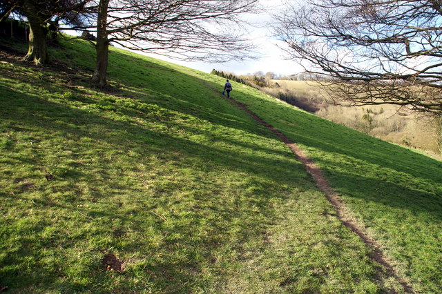
You can follow a section of The South Downs Way north west from the village to reach the viewpoint. It's about a 1.5 mile walk, steadily climbing to the 201 metre high hill summit. Here you'll also find a round barrow cemetery dating to the Late Neolithic or Bronze Age, which is designated as a scheduled monument.
There are fine views to the Itchen Vallley, the New Forest, the Solent and Isle of Wight and round to Portsdown Hill.
The hill is also a great place for flora and fauna with a wide variety of butterflies to be seen fluttering around the wildflowers. Look out for brown argus, green hairstreak, chalkhill blue, marbled white and dingy skipper as you make your way through area during the summer months.
Please note the site is not to be confused with Beacon Hill near Newbury. This hill is located some way to the north in the Highclere Castle Estate.
Beacon Hill Hampshire Ordnance Survey Map  - view and print off detailed OS map
Beacon Hill Hampshire Open Street Map  - view and print off detailed map
Beacon Hill Hampshire OS Map  - Mobile GPS OS Map with Location tracking
Beacon Hill Hampshire Open Street Map  - Mobile GPS Map with Location tracking
Pubs/Cafes
Back in Meonstoke you could enjoy post walk refreshment at the Bucks Head. The quaint inn is located in a fine spot close to the river and boasts a lovely garden area. You can find them on Shoe Lane, Exton with a postcode of SO32 3NT for your sat navs.
Further Information and Other Local Ideas
To the east of Meonstoke there's another popular local hill climb at Old Winchester Hill. The site is one of the highlights of the area with the hill and surrounding area a designated National Nature Reserve which includes a wide variety of butterflies and wildlife.
For more walking ideas in the area see the Hampshire Walks, South Downs Walks page.
Cycle Routes and Walking Routes Nearby
Photos
The top of Beacon Hill by the trig point, looking towards Old Winchester Hill with Butser Hill beyond.
Temporary route to Beacon Hill for cyclists and horse riders on the South Downs Way. In March 2009 a new temporary route for horse riders and cyclists was opened between Old Winchester Hill and Beacon Hill. This new route replaces the old temporary route that ran though Warnford. The South Downs Way website says "The route has been changed to improve the safety of users until agreement can be reached on a permanent route across the valley ... The old route is still usable but is not recommended and is not signed as the South Downs Way." The temporary route is likely to be in place until March 2011. This view is the upper part of a permissive stretch approaching the trig point on Beacon Hill, just beyond the wooden gate.


