Black Down
![]()
![]() Climb to the highest point in the South Downs on this challenging route in Sussex. The area is run by the National Trust and includes a series of well defined paths taking you to flower-rich meadows, ancient woodland and copses. There are fabulous views over the Weald from the Temple of the Winds, at the southern end of Black down. The English Channel can also be seen through the River Arun gap on a clear day. The circular route below starts at the car park near the Temple of the Winds and takes you north across Black Down to Boarden Door Bottom.
Climb to the highest point in the South Downs on this challenging route in Sussex. The area is run by the National Trust and includes a series of well defined paths taking you to flower-rich meadows, ancient woodland and copses. There are fabulous views over the Weald from the Temple of the Winds, at the southern end of Black down. The English Channel can also be seen through the River Arun gap on a clear day. The circular route below starts at the car park near the Temple of the Winds and takes you north across Black Down to Boarden Door Bottom.
Cyclists can also enjoy a number of easy bridleways or more challenging mountain bike trails which run across the area.
The Sussex Border Path walking trail runs through Black Down so you could pick up this trail and head west to the nearby Marley Common to continue your walk.
Black Down is located just a few miles south of Haslemere town centre. You can reach it from the train station on our Haslemere Circular Walk which also visits Marley Common.
Postcode
GU27 3BS - Please note: Postcode may be approximate for some rural locationsPlease click here for more information
Black Down Ordnance Survey Map  - view and print off detailed OS map
Black Down Open Street Map  - view and print off detailed map
Black Down OS Map  - Mobile GPS OS Map with Location tracking
Black Down Open Street Map  - Mobile GPS Map with Location tracking
Pubs/Cafes
Just to the south east of the site you'll find the picturesque village of Lurgashall where you could enjoy some post walk refreshment at The Noah's Ark Inn. The country pub has a fine interior with beams and an inglenook fire. Outside there's a nice garden area with a stretch tent and views of the cricket on the Green in the summer. You can find them on the Green at postcode GU28 9ET for your sat navs.
The village is also well worth exploring with a pretty village green, a millpond and a number of historic timber framed properties to admire. There's also the noteworthy St Laurence church which still has evidence of the original Saxon structure.
Dog Walking
The woodland trails around the Down are ideal for dog walking. You'll probably bump into plenty of other owners on a fine weekend day. The Noah's Ark mentioned above is also child and dog friendly.
Further Information and Other Local Ideas
Head a few miles north west and you could visit Ludshott Common and the popular beauty spot at Waggoners Wells.
For more walking ideas in the area see the South Downs Walks page.
Cycle Routes and Walking Routes Nearby
Photos
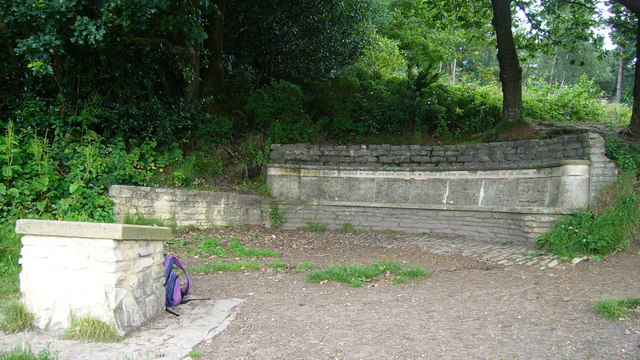
"Temple of the Winds" viewpoint. This viewpoint is on the Serpent Trail. The inscription reads "This seat was erected in memory of Mabel Elizabeth Hunter, wife of Edward W Hunter who gave Blackdown to the National Trust in 1944." Black Down is the highest point in all Sussex.
The heights of Black Down. The Down is quite flat-topped on the large scale, but the highest area is covered with small humps and hollows from ancient delving. This is typical terrain. Some of the humps near the trig point seem slightly higher than the base of the trig point, which is generally regarded as the highest point in Sussex at 280m.
Trig point at the top of Black Down, West Sussex. The forest is a mixture of deciduous and conifer, and very open and airy. The Down is owned by the National Trust: Sir Robert Hunter, one of the three original founders of the National Trust, lived in Haslemere from 1883 until his death in 1913.


