Blackness to South Queensferry Walk
![]()
![]() A coastal walk from Blackness to South Queensferry near Edinburgh. The route follows the John Muir Way for about 5.5 miles with fine views over the Firth of Forth.
A coastal walk from Blackness to South Queensferry near Edinburgh. The route follows the John Muir Way for about 5.5 miles with fine views over the Firth of Forth.
The walk starts at Blackness where features include the 15th century Blackness Castle and pier. From here you can pick up the John Muir Way and follow the trail east through Wester Shore Wood to Nethermill Bridge and Abercorn. The route then passes Hopetoun House where there is an expansive estate surrounding the 18th century country house. During the summer months, parts of the castle and gardens are open to visitors.
The route continues east past Society Point, East Shore Wood and Port Edgar before coming into Queensferry. Here you can extend the walk on the Forth Road Bridge which spans the Firth of Forth. There is a walkway/cycleway running across the bridge to North Queensferry where you can link up with the popular Fife Coastal Path.
Postcode
EH49 7NH - Please note: Postcode may be approximate for some rural locationsBlackness to South Queensferry Walk Ordnance Survey Map  - view and print off detailed OS map
Blackness to South Queensferry Walk Open Street Map  - view and print off detailed map
Blackness to South Queensferry Walk OS Map  - Mobile GPS OS Map with Location tracking
Blackness to South Queensferry Walk Open Street Map  - Mobile GPS Map with Location tracking
Pubs/Cafes
The historic Hawes Inn in Queensferry is a fine place for post walk refreshment. The pub dates from the 17th century and is noted for its connections with Robert Louis Stevenson's "Kidnapped". They serve good quality food and there are also fine views of the bridge's across the Forth. You can find them at 7 Newhalls Rd, South Queensferry, EH30 9TA.
Dog Walking
The coast and woodland trails are ideal for dog walking and the Hawes Inn mentioned above is also dog friendly.
Further Information and Other Local Ideas
To extend the walk pick up the Cramond to South Queensferry Walk and continue east to Cramond via Drum Sands and the historic Dalmeny House. Just to the south of Cramond you can visit the Cammo Estate. The park includes some splendid trails with lakes and the photogenic Cammo Tower to see.
For more walking ideas in the area see the Edinburgh Walks page.
Cycle Routes and Walking Routes Nearby
Photos
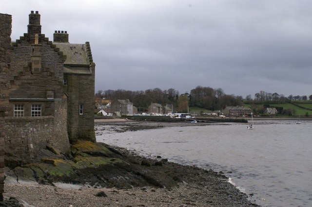
Blackness from the castle jetty. The building on the left is one of the 19th century additions. The harbour can be seen beside the village.
Foreshore near Hopetoun House. The tide being low, an expanse of sandy and stony beach is exposed on the south shore of the Firth of Forth. The Forth Bridges in the distance. The something below the bridges is the liner 'Crown Princess', which was moored between the Forth Bridge and the Forth Road Bridge. Passengers were disembarked at South Queensferry for shore excursions. A large area of the parking was closed off for the occasion, and the parking congestion and problems were greatly exacerbated by dozens of people who had come to view the liner.
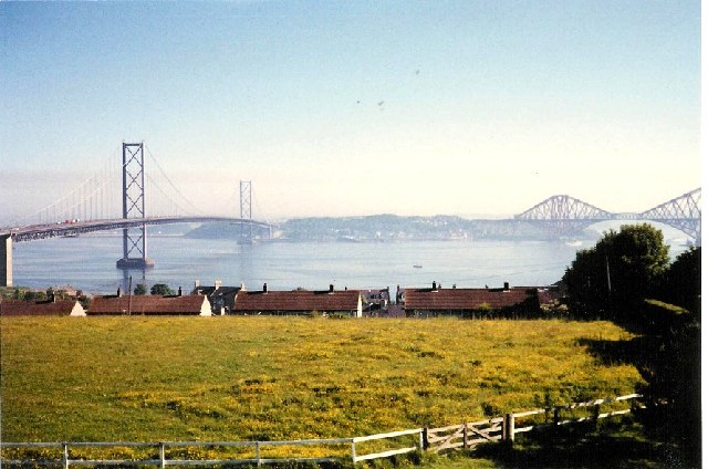
Bridges across the Firth of Forth at Queensferry. Ten miles west of Edinburgh, Queensferry has been an important crossing over the Firth of Forth since 1071 when Malcolm III granted free passage at the 'Queens Ferry' for pilgrims on their way to St Andrews. A townsman told me that the first bombs dropped on the United Kingdom in World War II were aimed at the bridge on the right of the picture.


