Brent Tor
![]()
![]() Enjoy a short climb to this distinctive Dartmoor Hill and visit the historic hill top Church of St Michael, the parish church of the village of Brentor, which lies below the Tor.
Enjoy a short climb to this distinctive Dartmoor Hill and visit the historic hill top Church of St Michael, the parish church of the village of Brentor, which lies below the Tor.
You can start the walk from the Church car park just to the west of the hill. From here you can pick up footpaths taking you up to the hill summit and the church. It's a short climb, taking place on a grassy path with some stone steps as you approach the summit. From the hill top there are wonderful views across the surrounding countryside of Devon. The Church of St Michel de Rupe (Saint Michael of the Rock') atop the Tor dates to the 13th century. The ancient church is still used on Christmas Day, Easter Day and for Evensong during the summer.
The hill is located just a short distance from Mary Tavy. Here you can pick up two long distance trails to further explore Dartmoor. You can follow the West Devon Way and the Dartmoor Way north to visit the splendid Lydford Gorge.
Postcode
PL19 0NP - Please note: Postcode may be approximate for some rural locationsBrent Tor Ordnance Survey Map  - view and print off detailed OS map
Brent Tor Open Street Map  - view and print off detailed map
Brent Tor OS Map  - Mobile GPS OS Map with Location tracking
Brent Tor Open Street Map  - Mobile GPS Map with Location tracking
Explore the Area with Google Street View 
Cycle Routes and Walking Routes Nearby
Photos
Brent Tor is the remains of an ancient volcano. It is formed from volcanic lava erupted undersea around 320 million years ago in the Carboniferous era. The hill stands at 330 metres above sea level and about 60 metres above the surrounding countryside. The church on the top dates from around the 13th century although human activity is known to go back to an Iron Age fort on the hill. There are great views from the top.
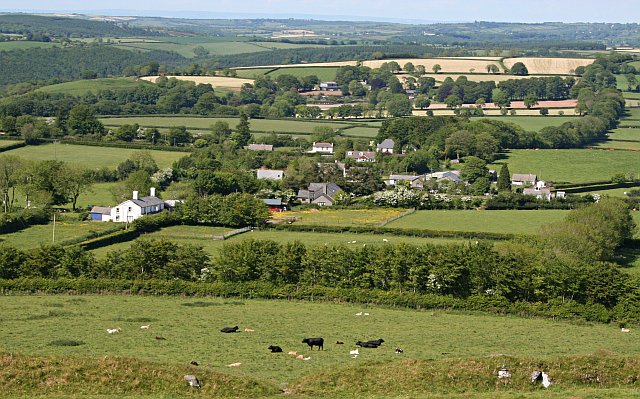
Beyond the crags is the view south from Brent Tor summit. If you are familiar with this countryside you would recognise on the very farthest horizon towards the right of the photograph the tiny slope which is the hillside of Mount Edgcumbe dropping down into Plymouth Sound about 30 kilometres to the south.


