Burnswark Hill Walk
![]()
![]() This walk climbs to the fine viewpoint at Burnswark Hill near Lockerbie in Dumfries and Galloway.
This walk climbs to the fine viewpoint at Burnswark Hill near Lockerbie in Dumfries and Galloway.
The hill is of some archeological significance having been the site of ancient Iron Age fort. There's also evidence of a Bronze Age burial cairn, Roman camps, some medieval enclosures and a potential Civil War battery in this fascinating area.
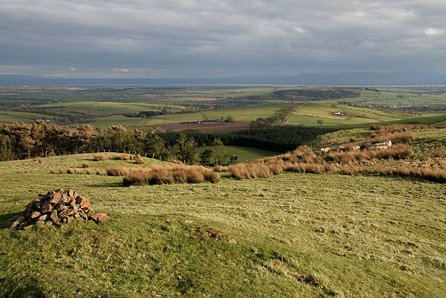
From the 287 metre high summit there are also some great views over the surrounding countryside and hills of Annandale.
Postcode
DG11 3JJ - Please note: Postcode may be approximate for some rural locationsBurnswark Hill Ordnance Survey Map  - view and print off detailed OS map
Burnswark Hill Open Street Map  - view and print off detailed map
*New* - Walks and Cycle Routes Near Me Map - Waymarked Routes and Mountain Bike Trails>>
Burnswark Hill OS Map  - Mobile GPS OS Map with Location tracking
Burnswark Hill Open Street Map  - Mobile GPS Map with Location tracking
Further Information and Other Local Ideas
Head west towards Lockerbie and you could pick up the Annandale Way, a 90-kilometre (56 mi) hiking trail, which is officially designated by NatureScot as one of Scotland's Great Trails. The trail provides great views of the River Annan which flows through the area. In this area you can also visit Lochmaben and enjoy a circular walk around the loch with a vist to the remains of the 12th century Lochmaben Castle.
Cycle Routes and Walking Routes Nearby
Photos
Burnswark Hill. A prominent Annandale landmark. On the flat-topped summit is an Iron Age fort dating from 600 BC, with the impressive ramparts of later 2nd century AD Roman forts immediately to the north and south. New research suggests that Burnswark may have been the location for the 10th century Battle of Brunanburh, previously thought to have been in England.
A cairn on Burnswark Hill. This small pile of stones, marked as a cairn on the Explorer Map, is at the northeast end of this interesting hill, the site of an Iron Age fort and Roman fort.


