Caerleon Walk
![]()
![]() This river walk visits some of the highlights of the area around Caerleon including the Roman Fortress, Chepstow Hill and Wentwood Forest.
This river walk visits some of the highlights of the area around Caerleon including the Roman Fortress, Chepstow Hill and Wentwood Forest.
The walk starts in the town at the notable Roman legionary fortress. You then follow paths to the river, passing the Roman Amphitheatre on the way. At the river you pick up the Usk Valley Walk and follow the waymarked trail along the river before picking up the old Roman Road to take you up to Chepstow Hill.
You continue along the Roman Road to Cat's Ash before entering the woodland area at Kemeys Graig. Follow the trails north east and they will take you into Wentwood Forest where you come to the hill which marks the high point of the forest.
The trail then returns to Caerleon on the same paths.
Caerleon Ordnance Survey Map  - view and print off detailed OS map
Caerleon Open Street Map  - view and print off detailed map
Caerleon OS Map  - Mobile GPS OS Map with Location tracking
Caerleon Open Street Map  - Mobile GPS Map with Location tracking
Further Information and Other Local Ideas
You can extend your walk by continuing north along the river path to visit Newbridge on Usk. The pretty village includes a photogenic 18th century red sandstone bridge and a fine riverside pub. Continuing further will take you into Usk where you can see the 12th century Usk Castle, a Grade I listed building.
Cycle Routes and Walking Routes Nearby
Photos
Roman remains. Here we see the remains of the ramparts and ditch surrounding the Roman fortress of Isca. The ramparts would have been topped by timber palisades when originally built c 78AD, these were replaced by stone ones early in the 2nd century. The whole area surrounded by these defences covered about 50 acres.
Roman amphitheatre. This is the best preserved amphitheatre in Britain. Until 1926, the site was a circular earthwork enclosing a deep hollow and was known as King ARthur's Round Table. However, earlier excavations in 1909 had revealed that it was an amphitheatre and further excavations in 1926 found eight entrances and seating capacity for 6000 people.
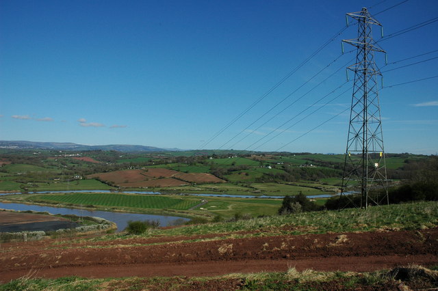
On Chepstow Hill. A pylon carries electricity power lines over Chepstow Hill near Caerleon, the meandering River Usk at high tide can be seen in the valley below.


