Cannop Ponds Circular Walk Map
![]()
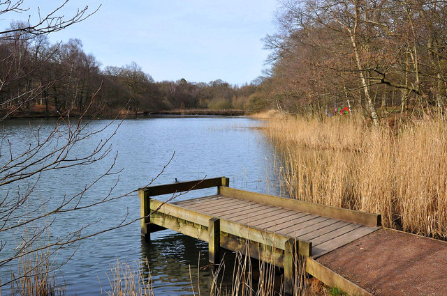
![]() These two large ponds in the Forest of Dean are a lovely spot for an easy afternoon stroll. It's a nice gentle circular walk of just over a mile on good footpaths with lovely scenery and wildlife to enjoy.
These two large ponds in the Forest of Dean are a lovely spot for an easy afternoon stroll. It's a nice gentle circular walk of just over a mile on good footpaths with lovely scenery and wildlife to enjoy.
You can start the walk from the car park on the New Road, next to the northern pond. Then pick up the waymarked trail which heads between the ponds and then south along the pretty Cannop Brook to the other ponds. Look out for Mandarin ducks, reed warblers and a pair of nesting mute swans on the water. There's also lots of interesting plants with common spotted-orchid, marsh pennywort, common valerian, skullcap and creeping jenny adding to the area's charm.
The ponds are on the circular Forest of Dean Family Route. You can pick up the cycling and walking trail to further explore the area. Following the trail just a mile north will take you to the splendid Forest of Dean Sculpture Trail and Speech House Walk.
Just to the south west you will find the magical Puzzlewood. There's a maze of footpaths to follow around the 14 acre site with interesting geological features, caves and ancient trees.
Postcode
GL15 4JS - Please note: Postcode may be approximate for some rural locationsCannop Ponds Ordnance Survey Map  - view and print off detailed OS map
Cannop Ponds Open Street Map  - view and print off detailed map
*New* - Walks and Cycle Routes Near Me Map - Waymarked Routes and Mountain Bike Trails>>
Cannop Ponds OS Map  - Mobile GPS OS Map with Location tracking
Cannop Ponds Open Street Map  - Mobile GPS Map with Location tracking
Further Information and Other Local Ideas
Just over a mile to the north east there's the Speech House Walk to try. The circular trail takes you around the Speech House Inclosure, visiting the picturesque Speech House Lake and the lovely Cyril Hart Arboretum. Near here you can also visit the Speech House Hotel and enjoy afternoon tea in the 17th century former hunting lodge.
Just south of the ponds there's the Nagshead Nature Reserve to explore. The RSPB reserve includes a Visitor centre, viewing hides, two waymarked trails, a picnic area and lots of wildlife.
To the east there's the New Fancy Viewpoint. Set on the site of the old coal mine the viewpoint is a fine place to watch birds of prey soaring through the skies above. There's also the 'Roll of Honour' sculpture and the Geomap - a map you can walk on showing the underlying geology of the forest. A car park and picnic area add to the attraction.
Cycle Routes and Walking Routes Nearby
Photos
Angling sign at the site. Here the start of the second and smaller of the two Cannop Ponds can be seen through the trees.
Picnic area and bridge at the southern end. A nice place to enjoy a sandwich with a view. The lower pond was created in 1825 to supply water, via a leat, to a waterwheel at Parkend Ironworks.


