GPS Cycle and Walking Routescycle iconwalk icon

Cefn Coed Viaduct Walk

3.1 miles (5 km)

Ordnance Survey Map Open Streetmap This walk visits the impressive Cefn Coed Viaduct in the village of Cefn-coed-y-cymmer in Merthyr Tydfil.
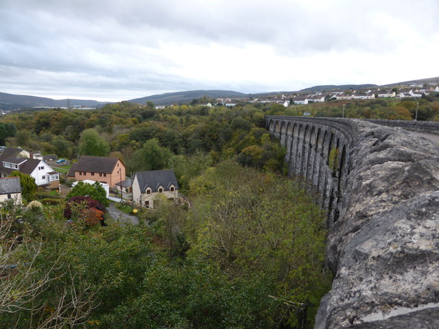
There is a shared cycling and walking trail running over the viaduct along part of the popular Taff Trail. You can pick up the trail near the High Street in Cefn-coed-y-cymmer. Then head south, crossing the viaduct and the river. The structure spans the Taf Fawr river and was constructed as part of the Merthyr- Pontsticill junction railway line. It dates back to the mid 19th century and is the third largest in Wales. From the top there are some excellent views over the town to the surrounding hills and mountains.

Cefn Coed Viaduct OS Map Ordnance survey map - Mobile GPS OS Map with Location tracking

Cefn Coed Viaduct Open Street Map Open Streetmap - Mobile GPS Map with Location tracking

Cycle Routes and Walking Routes Nearby

Photos

Taff Trail, at end of Cefn viaduct - geograph.org.uk - 1998376

Taff Trail, at end of Cefn viaduct

Cefn-coed-y-cymmer, viewed from Cefn viaduct - geograph.org.uk - 1998545

Cefn-coed-y-cymmer, viewed from Cefn viaduct

Cefn Coed Viaduct - Merthyr Tydfil - geograph.org.uk - 1363861

The viaduct from a distance

Cyclist on Cefn Coed Viaduct - geograph.org.uk - 3435591

Cyclist on Cefn Coed Viaduct

On the Cefn-coed-y-cymmer viaduct in Merthyr - geograph.org.uk - 3718669

Another view from the top.

The view (SE) from Cefn Coed Viaduct, Merthyr Tydfil - geograph.org.uk - 3452781

Looking SE down to the river.

Video

GPS Files

GPX File

Cefn Coed Viaduct.gpx (On Desktop:Right Click>Save As. On Ipad/Iphone:Click and hold>Download Linked File)