Chard Reservoir
![]()
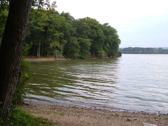
![]() Enjoy an easy circular walk around this pretty reservoir in Somerset. The area is also a designated nature reserve with lots of interesting flora and fauna to look out for on the way. There's a splendidly positioned bird hide where you can look out for birds including little egrets, cormorants, tufted ducks and wigeon. It's a lovely, peaceful spot and well worth a look if you are visiting the area.
Enjoy an easy circular walk around this pretty reservoir in Somerset. The area is also a designated nature reserve with lots of interesting flora and fauna to look out for on the way. There's a splendidly positioned bird hide where you can look out for birds including little egrets, cormorants, tufted ducks and wigeon. It's a lovely, peaceful spot and well worth a look if you are visiting the area.
The reservoir is located just to the north east of Chard town centre. You could start the walk from here or from the car park at the southern end of the water. Then pick up the surfaced trails heading around the site.
Postcode
TA20 1RR - Please note: Postcode may be approximate for some rural locationsChard Reservoir Ordnance Survey Map  - view and print off detailed OS map
Chard Reservoir Open Street Map  - view and print off detailed map
Chard Reservoir OS Map  - Mobile GPS OS Map with Location tracking
Chard Reservoir Open Street Map  - Mobile GPS Map with Location tracking
Pubs/Cafes
There's lots of good options for refreshments in Chard town centre but we recommend heading to the Windwhistle Inn a little out of town. The main attraction here is a lovely 5 acre garden with panoramic views. On a clear day and you can see all the way to Glastonbury Tor and the Bristol Channel from here. It's a great place to relax and enjoy a meal on a summer day. Children and dogs are welcome in this expansive area too.
The inn also has an interesting history dating right back to the 17th Century when it was a notorious haunt of smugglers and highwaymen. More recently in 1902 Thomas Hardy mentioned the inn by name in his poem "A Trampwoman's Tragedy". It has a very good menu and a large car park too. You can find it on the A30 near Cricket St Thomas at a postcode of TA20 4DQ for your sat navs.
Further Information and Other Local Ideas
Just to the east of the town you'll find Cricket St Thomas. There's 160 acres of lovely parkland and gardens with peaceful lakes, secluded woodland and beautiful gardens to explore.
The famous Cheddar Gorge, Cheddar Reservoir, the historic town of Axbridge and the wooded valley of Goblin Combe are also nearby.
Cycle Routes and Walking Routes Nearby
Photos
Chard Reservoir. The former reservoir and some of the surrounding land is now a nature reserve. The reservoir was built in 1842 to provide water for the nearby Chard Canal, and so became redundant in 1868 when the canal closed.
Chard, old railway formation. On the western side of the reservoir you can pick up this cycle trail along the old railway line. The surfaced trail is also suitable for walkers. See the Chard to Ilminster Cycle Path page for more details.


