Chelmsford Walks
![]()
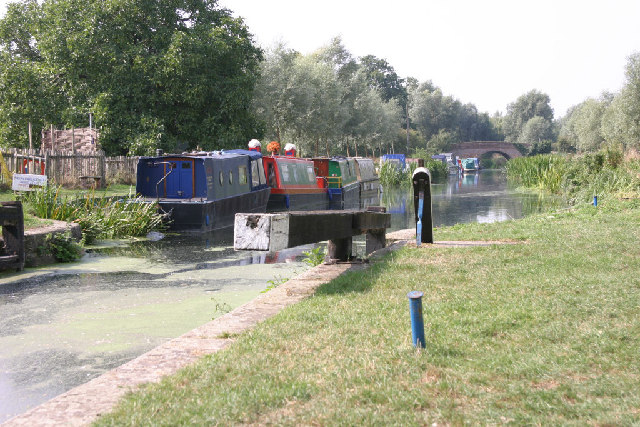
![]() This walk in the Essex city of Chelmsford takes you along the River Can and River Chelmer to Sandford Mill. The walk starts in Central Park where there is the impressive 18-arch Victorian railway viaduct spanning the River Can. It's a lovely place to start the walk with a pretty lake, bell meadow and the Marconi Ponds local nature reserve. After strolling through the park you pick up the riverside footpaths along the Can, heading east and passing the Essex County Cricket Ground on the other side of the river. You continue east with the option of taking a detour north along the River Chelmer to the Chelmer Valley Nature Reserve. It's only a mile to the north and runs for approximately 2.5km from Valley Bridge to Victoria Road. This route continues east along the Chelmer, passing pretty meadows on your way to Sandford Mill. Here you could pick up the Centenary Circle and Chelmer and Blackwater Navigation Canal long distance trails and further explore the area around the city. The canal will take you along the easy towpath to the delightful Paper Mill Lock and the attractive town of Maldon on the Blackwater Estuary.
This walk in the Essex city of Chelmsford takes you along the River Can and River Chelmer to Sandford Mill. The walk starts in Central Park where there is the impressive 18-arch Victorian railway viaduct spanning the River Can. It's a lovely place to start the walk with a pretty lake, bell meadow and the Marconi Ponds local nature reserve. After strolling through the park you pick up the riverside footpaths along the Can, heading east and passing the Essex County Cricket Ground on the other side of the river. You continue east with the option of taking a detour north along the River Chelmer to the Chelmer Valley Nature Reserve. It's only a mile to the north and runs for approximately 2.5km from Valley Bridge to Victoria Road. This route continues east along the Chelmer, passing pretty meadows on your way to Sandford Mill. Here you could pick up the Centenary Circle and Chelmer and Blackwater Navigation Canal long distance trails and further explore the area around the city. The canal will take you along the easy towpath to the delightful Paper Mill Lock and the attractive town of Maldon on the Blackwater Estuary.
Chelmsford Ordnance Survey Map  - view and print off detailed OS map
Chelmsford Open Street Map  - view and print off detailed map
Chelmsford OS Map  - Mobile GPS OS Map with Location tracking
Chelmsford Open Street Map  - Mobile GPS Map with Location tracking
Walks near Chelmsford
- Blake's Wood - Enjoy a series of nice woodland trails in this pretty wood in Chelmsford
- Chelmer and Blackwater Navigation - Follow the Chelmer and Blackwater Navigation Canal from Chelmsford to Maldon on this easy, waterside walk in Essex
- Saffron Trail - A walk through the Essex countryside from the coast at Southend-on-Sea to Saffron Walden
- Danbury Country Park - This country park in Essex has a number of good walking trails to enjoy
- Danbury Common - This large area of woodland and heath is managed by the National Trust
- Centenary Circle - This circular walk takes you through the parks and countryside around Chelmsford.
The walk starts on Sandford Mill bridge on the Chelmer and Blackwater Navigation and passes Sandon, Chignal Smealey, Galleywood, Writtle and Broomfield - Hylands Park - This lovely park near Chelmsford is a great place for an afternoon stroll
- Paper Mill Lock - Enjoy an easy stroll along the Chelmer and Blackwater Navigation on this circular waterside walk from Paper Mill Lock
- Galleywood Common - This circular walk visits Galleywood Common near Chelmsford
- Terling - This pretty Essex village has many picturesque features including a ford on the River Ter, an old windmill, a cricket pitch and cottages around Church Green.
Further Information and Other Local Ideas
A few miles south of the city centre there's a very pleasant area of open access land in the shape of Galleywood Common. The common includes easy woodland trails and open grassland with a good commonside pub to visit as well. It's a fine place to walk the dog, fly a kite and enjoy some peaceful surroundings near the city.
For more walking ideas in the area see the Essex Walks page.


