Chipping Sodbury Circular Walk with OS Map
![]()
![]() This market town in South Gloucestershire is surrounded by some lovely Cotswolds countryside. Several waymarked trails run through the town providing the opportunity of exploring the area on well maintained walking paths. The town itself is very pleasant for a stroll with a series of 17th century stone cottages on the attractive Broad Street.
This market town in South Gloucestershire is surrounded by some lovely Cotswolds countryside. Several waymarked trails run through the town providing the opportunity of exploring the area on well maintained walking paths. The town itself is very pleasant for a stroll with a series of 17th century stone cottages on the attractive Broad Street.
This route follows sections of the Monarch's Way, the Cotswold Way and the Frome Valley Walkway to create a circular walk around the town. On the way you'll visit the little neighbouring villages of Little Sodbury and Old Sodbury. There's also some nice waterside trails along the River Frome and an old Fort to see on the way.
The walk starts in the town centre where you can pick up the Monarch's Way and follow the waymarked footpath north east along the Frome and out into the countryside. The trail will take you to Winchcombe Farm before coming to Little Sodbury. This interesting village includes the 15th century manor house which once played host to Henry VIII and Anne Boleyn.
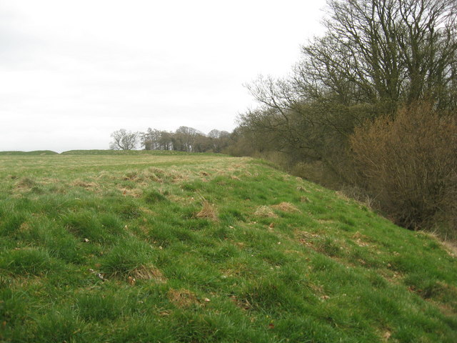
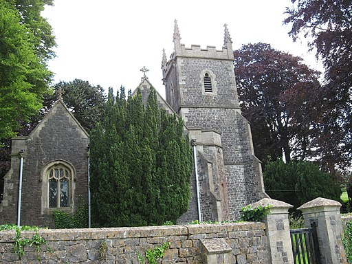
The trail turns south from the village to pass Little Sodbury Wood and the Iron Age Hillfort before coming to Old Sodbury. There's a picturesque church dating from the 12th century here which is well worth investigating. There's also some nice views from the elevated position of the fort.
At Old Sodbury you pick up the Frome Valley Walkway and follow the waymarked trail west along the river. It will lead you back into Chipping Sodbury where the route finishes.
Chipping Sodbury Ordnance Survey Map  - view and print off detailed OS map
Chipping Sodbury Open Street Map  - view and print off detailed map
*New* - Walks and Cycle Routes Near Me Map - Waymarked Routes and Mountain Bike Trails>>
Chipping Sodbury OS Map  - Mobile GPS OS Map with Location tracking
Chipping Sodbury Open Street Map  - Mobile GPS Map with Location tracking
Pubs/Cafes
Back in the town head to The Horseshoe for some post walk refreshments. The friendly pub has a great atmosphere and a nice little garden for warmer days. It has some history too, being set in a wonderful building dating back to the 15th century. They are nicely located on the High Street at postcode BS37 6AH for your sat navs.
Just up the road there's The Royal Oak. The 17th century inn does fine home cooked food in the restaurant. You can find them on Broad Street at postcode BS37 6AG.
Dog Walking
The country trails make for a nice dog walk and the Royal Oak pub mentioned above is also dog friendly.
Further Information and Other Local Ideas
The town is located close to the splendid Westonbirt Arboretum where there is a fine collection of specimen trees.
The Yate Walk starts in the adjacent town. It follows a similar route but additionally heads north to Mead Riding and Yate Rocks, next to the old quarries.
The Badminton House and Estate is a few miles east of the town. There's some lovely scenery here around the site of the famous Badminton Horse Trials.
Just south of Old Sodbury you could follow the Cotswold Way to Dodington Park. The estate comprises some 300 acres of landscaped park with woods, lakes, lodges, a dower house, an orangery, a church, and a walled kitchen garden. Continue south and you will soon come to the noteworthy Dyrham Park. The 270 acre park includes beautiful gardens and a herd of resident deer.
Just a few miles to the north east you can pick up the circular Hawkesbury Upton Walk and visit the National Trust's Horton Court. The Grade I listed manor house dates back to the 16th century and is surrounded by some pretty gardens. In the area there's also a historic 400 year old pub and the Somerset Monument to visit.
For more walking ideas in the area see the Cotswolds Walks and Gloucestershire Walks pages.
Cycle Routes and Walking Routes Nearby
Photos
Chipping Sodbury, Broad Street. The former market place is a long and wide street lined by many pubs and shops. Chipping comes from the Old English for market.
Old Sodbury Church (Saint John the Baptist). 12th Century Transitional Norman nave, aisles and chancel with 13th Century Early English transepts and 15th Century Perpendicular tower. Heavily restored in 1858 by T H Wyatt. Pictured is the approach to the church through the churchyard - note sign on tree warning of snakes!


