Circular Walk from Ambleside
![]()
![]() This circular walk from Ambleside visits some of the highlights of the area including Stock Ghyll Force Waterfall, Wansfell Pike, Jenkin's Crag, Stagshaw Gardens, Lake Windermere, Ambleside Roman Fort, the River Rothay and Rothay Park. It's a varied 4.5 mile walk with some moderate climbs and fabulous views throughout.
This circular walk from Ambleside visits some of the highlights of the area including Stock Ghyll Force Waterfall, Wansfell Pike, Jenkin's Crag, Stagshaw Gardens, Lake Windermere, Ambleside Roman Fort, the River Rothay and Rothay Park. It's a varied 4.5 mile walk with some moderate climbs and fabulous views throughout.
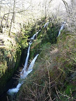
The walk starts in Ambleside town centre, following a road up to a wooded valley with a series of pretty waterfalls. After emerging from the valley you follow trails east up to Wansfell Pike. From the 482 metre peak there are stunning views of the Coniston Fells, Fairfield, Lake Windermere and Red Screes.
The route then descends south to Jenkin's Crag and Skelghyll Wood. Here you will find the pretty Stagshaw Gardens which are owned by the National Trust. The garden is noted for its shrubs, including rhododendrons, azaleas and camellias. There are also nice views over Windermere Lake to enjoy from the elevated garden.
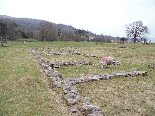
The walk then descends to the lakeside at Waterhead where you can boats to Bowness. You pass the piers before heading through Borrans Park to the Ambleside Roman Fort. The fort is Grade I listed and dates from the 1st or 2nd century. It was probably built under Hadrian's rule to guard the Roman road from Brougham to Ravenglass.
The route then heads north to follow some lovely waterside paths along the River Rothay to Rothay Park. Heading east through the attractive park will take you past the church and back into the town.
Circular Walk from Ambleside Ordnance Survey Map  - view and print off detailed OS map
Circular Walk from Ambleside Open Street Map  - view and print off detailed map
Circular Walk from Ambleside OS Map  - Mobile GPS OS Map with Location tracking
Circular Walk from Ambleside Open Street Map  - Mobile GPS Map with Location tracking
Circular Walks near Ambleside
- Red Screes - This circular route takes you up Red Screes fell in the Lake District National Park
- Wansfell Pike - This circular walk in the Lake District takes you up Wansfell Pike fell to Troutbeck, and then back through Skelghyll woods
- Loughrigg Tarn - This circular walk takes you to the lovely Loughrigg Tarn from Skelwith Bridge
- Kentmere Horseshoe - This challenging circular route explores the range of fells in the upper Kentmere valley area of the Lake District. The route visits some of the quieter areas of the national park while visiting a series of lesser known fells
- Windermere - With its mainline train station, beautiful lake and excellent facilities Windermere is a popular tourist destination for walkers
- Skelwith Bridge - With the long distance Cumbria Way passing through the village and a series of beatiful waterfalls to visit, the village of Skelwith Bridge is a great place for walkers
- Rydal Water - Enjoy a wonderful circular walk around the beautiful Rydal Water in the Lake District
- Kentmere Reservoir - This circular walk visits Kentmere Reservoir from the village of Kentmere in the Lake District.
You start of from Kentmere where you can follow public footpaths north to the reservoir - Yoke - This walk climbs to Yoke Fell in the eastern part of the Lake District National Park.
Pubs/Cafes
The 17th century Wateredge Inn is a great place for refreshments with a lake view. It's located right next to Lake Windermere and includes a large outdoor seating area which is perfect for summer days. You can find it on Borrans Road, Ambleside, with a postcode of LA22 0EP for your sat navs.


