Clava Cairns and Culloden Viaduct Walk
![]()
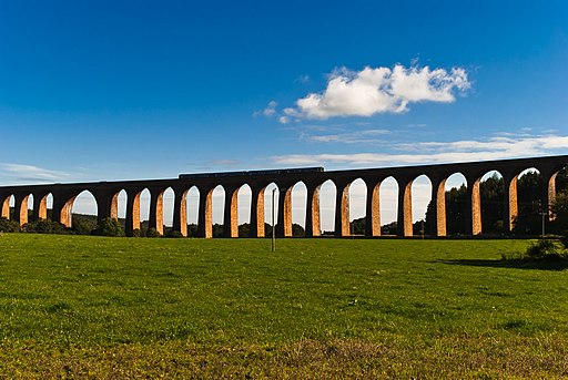
![]() This circular walk visits the ancient Clava Cairns near Inverness. The walk also takes you to the photogenic Culloden Viaduct which lies just the east of the site.
This circular walk visits the ancient Clava Cairns near Inverness. The walk also takes you to the photogenic Culloden Viaduct which lies just the east of the site.
The cairns date back to the Bronze Age and are over 4,000 years old. You can stroll around the site and visit a series of prehistoric burial monuments and the remains of a medieval chapel.
After exploring the ancient tombs you can pick up some pleasant country lanes and follow them around the Culloden Viaduct. The impressive structure carries the Highland Main Line over the wide valley of the River Nairn. On this section you can enjoy fine views to the viaduct and the Cassie Burn around Dalroy Woods.
To continue your walking in the area head west to visit the Culloden Battlefield. The historic site includes decent footpaths, a visitor centre and a museum where you can learn all about the Jacobite Rising in 1746.
Clava Cairns and Culloden Viaduct Ordnance Survey Map  - view and print off detailed OS map
Clava Cairns and Culloden Viaduct Open Street Map  - view and print off detailed map
Clava Cairns and Culloden Viaduct OS Map  - Mobile GPS OS Map with Location tracking
Clava Cairns and Culloden Viaduct Open Street Map  - Mobile GPS Map with Location tracking
Further Information and Other Local Ideas
A few miles to the north east there's more interesting local history at Cawdor Castle and Woods. The 15th century castle is surrounded by beautiful grounds and gardens with more trails through the adjacent Cawdor Woods.


