Coldstones Cut
![]()
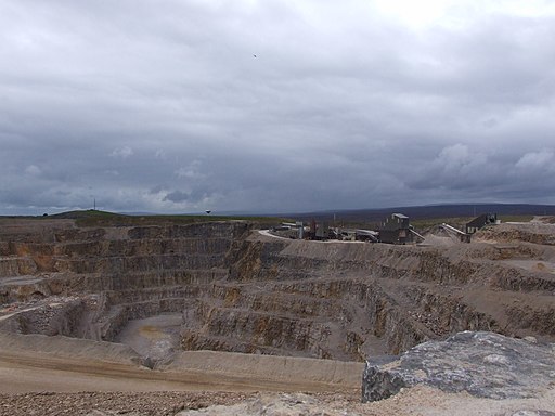
![]() This walk visits the photogenic Coldstones Cut, a huge public artwork on Greenhow Hill in North Yorkshire.
This walk visits the photogenic Coldstones Cut, a huge public artwork on Greenhow Hill in North Yorkshire.
You can start the walk from the Coldstones Cut Parking Area near the Toft Gate Lime Kiln. From here you can follow footpaths south to the viewing platform. There's wonderful views over the site and also towards the surrounding hills and countryside from this elevated spot. After admiring the views you can then explore the site on different winding footpaths. It's an unusual and fascinating walk taking you around the old quarry while complementing the surrounding landscape of the Nidderdale AONB.
The historic lime kilns at the start of the walk are also worth exploring. They date back to the mid 19th century are and are some of the most significant in the country.
Postcode
HG3 5BJ - Please note: Postcode may be approximate for some rural locationsPlease click here for more information
Coldstones Cut Ordnance Survey Map  - view and print off detailed OS map
Coldstones Cut Open Street Map  - view and print off detailed map
Coldstones Cut OS Map  - Mobile GPS OS Map with Location tracking
Coldstones Cut Open Street Map  - Mobile GPS Map with Location tracking
Further Information and Other Local Ideas
The Bewerley Industrial Heritage Trail passes the site. The historical trail explores centuries of local lead mining history and is a good way to extend your walking in the area.
Just to the east you can pick up the Pateley Bridge Circular Walk and visit the expansive Gouthwaite Reservoir.
For more walking ideas in the area see the Nidderdale Walks page.
Cycle Routes and Walking Routes Nearby
Photos
Toft Gate Lime Kiln, Greenhow. The kiln in the foreground was loaded with limestone through the top and with coal through the rectangular openings in the end and side walls. A stone lined flue runs from the kiln up a gentle slope to the chimney base in the distance. The hill behind the chimney is the west flank of the modern day limestone quarry.
Toft Gate lime kiln. There are probably thousands of old lime kilns in the Dales, but only one or two which were built on an industrial scale like this one. The kiln dates from 1860 and is situated at the easternmost point of the carboniferous limestone outcrops that continue into Wharfedale. By 1860 there was a railway at nearby Pateley Bridge, so the lime could be exported. The only problem was the steep hill down to the town. On one occasion it is recorded that a great crowd turned out to see a steam traction engine pulling a wagon up the hill to the lime works.


