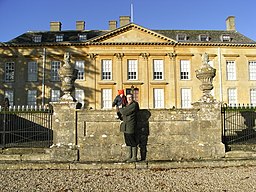
Cornbury Park
![]()
![]() A circular walk around the Cornbury Park estate in Charlbury. The estate is not generally open to the public but there are public footpaths from which there are fine views of the estate. Highlights on the walk include views of the River Evenlode, several pretty lakes, peaceful woodland trails and views of the deer on the estate.
A circular walk around the Cornbury Park estate in Charlbury. The estate is not generally open to the public but there are public footpaths from which there are fine views of the estate. Highlights on the walk include views of the River Evenlode, several pretty lakes, peaceful woodland trails and views of the deer on the estate.
The route starts in Charlbury and heads west to cross the River Evenlode. You then head south along the Lower Park, skirting the edge of the series of lakes in the park.
At Finstock you turn north west, passing through a section of Wychwood Forest where there are more lakes and ponds to be seen.
The trail continues north along Catsham Lane where you link up with the Oxfordshire Way. You can follow the waymarked trail east back into Charlbury.
The estate does run events from time to time allowing access to the internal grounds. See the link below for more details.
Please click here for more information
Cornbury Park Ordnance Survey Map  - view and print off detailed OS map
Cornbury Park Open Street Map  - view and print off detailed map
Cornbury Park OS Map  - Mobile GPS OS Map with Location tracking
Cornbury Park Open Street Map  - Mobile GPS Map with Location tracking
Pubs/Cafes
Back in Charlbury there's several good choices for post walk refreshments. The Rose and Crown has an excellent selection of beers and were voted CAMRA Oxfordshire Pub of the Year and North
Oxfordshire Pub of the Year in 2018. You can find the pub at 1 Market St with a postcode of OX7 3PL for your sat navs.
The Rose and Crown doesn't do food so if you're looking for a bite to eat head to The Bell Inn. The pub is set in a beautiful 18th century Cotswold stone building and has a very good menu. You can find it on Church Street at postcode OX7 3PP.
Dog Walking
The country trails and woodland paths on the walk are ideal for dogs. The Rose and Crown and Bell Inn pubs mentioned above are also dog friendly.
Further Information and Other Local Ideas
To continue your walking in the area you could try the Charlbury Circular Walk. This explore the countryside around the river to the north west of the town.
Cycle Routes and Walking Routes Nearby
Photos
The banks are quite noticeable with their rectangular outline. Looking over the wall of Cornbury Park.
North Lodge. The park was originally a hunting lodge in the royal forest of Wychwood. It now hosts events such as the Cornbury Festival, featuring middle-of-the-road music, sponsored in 2005 by Waitrose and nicknamed 'Poshstock' by one newspaper. According to Pevsner, this lodge at the north gate (and a twin to the right of the gate) dates from the start of the 20th century, and are by John Belcher.


