Cow and Calf and Twelve Apostles Walk
![]()
![]() This circular walk visits two of the higlights of Ilkley Moor and Burley Moor in West Yorkshire.
This circular walk visits two of the higlights of Ilkley Moor and Burley Moor in West Yorkshire.
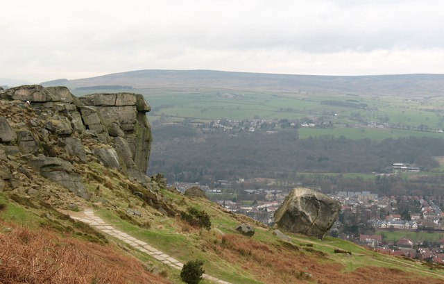
The walk starts from the Cow and Calf parking area on Hangingstone Road, just to the south east of the town of Ilkley. From here you can pick up footpaths onto the moor, taking you to the famous 'Cow and Calf', a large rock formation consisting of an outcrop and boulder, also known as Hangingstone Rocks. The distinctive rocks are made of millstone grit and are so named because one is large, with the smaller one sitting close to it, like a cow and calf.
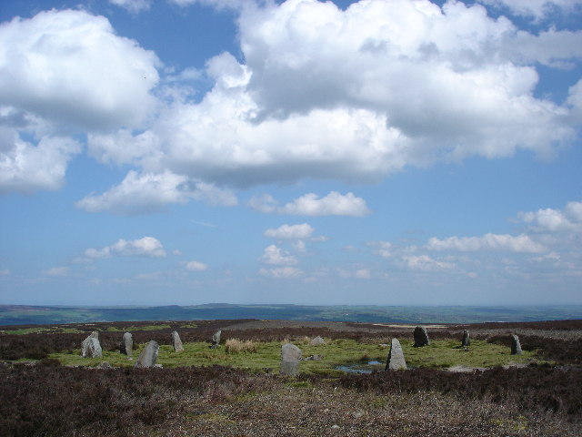
From here you head west to meet up with the Backstone Beck. A nice footpath runs south along the beck to take you to the Twelve Apostles stone circle. The bronze age stones are an impressive sight, set in an elevated position on Burley Moor, nearly 400 metres above sea level. The circle originally had between 16 and 20 stones, but it is now reduced to 12 stones with a diameter of about 15 metres.
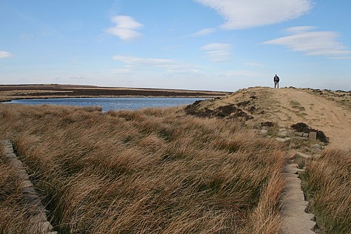
After exploring the stones the route continues east across Burley Moor to the pretty Lower Lanshaw Dam. The path passes along the northern end of the water before linking up with the Ebor Way long distance footpath. This will then take you in a north west direction, leading you back to the car park and the finish point of the walk. Here you can enjoy well earned refreshments at the popular Cow and Calf pub.
For an alternative circular walk see the Ilkley Moor Walk which heads west across the moor to visit Cranshaw Thorn Hill and Whetstone Gate.
To extend the walk you could follow the Ebor Way into Ilkley and enjoy a riverside walk along the River Wharfe. See the Ilkley to Addingham Walk for more details.
Postcode
LS29 8RF - Please note: Postcode may be approximate for some rural locationsCow and Calf and Twelve Apostles Ordnance Survey Map  - view and print off detailed OS map
Cow and Calf and Twelve Apostles Open Street Map  - view and print off detailed map
Cow and Calf and Twelve Apostles OS Map  - Mobile GPS OS Map with Location tracking
Cow and Calf and Twelve Apostles Open Street Map  - Mobile GPS Map with Location tracking
Pubs/Cafes
Right next to the site you'll find the Rock Cafe. They have a good selection of meals and snacks which you can enjoy with a view over the moor. The 19th century Cow and Calf pub is also nearby. They serve good quality pub grub and have a fine garden area for warmer weather. You can find them on the Hangingstone Road at postcode LS29 8BT for your sat navs.
Dog Walking
The moor is ideal for dog walking so you'll probably see other owners on your visit. Both the Rock Cafe and the pub mentioned above are also dog friendly.
Further Information and Other Local Ideas
The Burley in Wharfedale Walk visits the site from the train station at the nearby settlement. The village itself is well worth exploring with a delightful village green and some historic old buildings on the Main Street. It's located just a couple of miles north east of the rocks.
For more walking ideas in the area see the Yorkshire Dales Walks page.


