Dale Peninsula
![]()
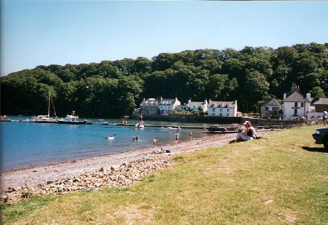
![]() Explore the beautiful Dale Peninsula on this circular walk along the Pembrokeshire Coast Path. The route runs for just under 7 miles with some moderate climbs on the undulating path on the way.
Explore the beautiful Dale Peninsula on this circular walk along the Pembrokeshire Coast Path. The route runs for just under 7 miles with some moderate climbs on the undulating path on the way.
The walk starts in the picturesque village of Dale which is located a few miles west of Milford Haven. In the village you can pick up the coastal path on the eastern side. The path then heads south to visit Dale Fort. The fort is a Victorian era fort located on a rocky promontory that now houses a field studies centre, for study of local marine biology, biology, geology, geomorphology, and other related fields. You continue to Castlebeach Bay, Watwick Point, Mill Bay and St Ann's Head. Here you will find a lighthouse that overlooks the entrance to the Milford Haven waterway, one of Britain's deep water harbours. The lighthouse is intended to guide ships around a number of rocky shoals that cause a hazard to shipping entering the Haven as well as Crow's rock. The current lighthouse was completed in 1844 and commissioned by John Knott, senior lighthouse keeper with Trinity House.
After enjoy the fine cliff top views you turn north to Frenchman's Bay, Welshman's Bay and Westdale Bay. From here you head east to Dale Castle before returning to the village.
To continue your walking in the area head west along the coast path to visit the nearby Marloes Sands. The National Trust managed area also includes Marloes Mere and a wide variety of wildlife to see. Also nearby is the delightful Martin's Haven. Here you can catch a boat to Skomer Island where you can look out for a huge variety of wildlife including Puffins, Manx Shearwaters, Dolphins, Harbour Porpoises, Razorbills, Gannets and Fulmars.
Dale Peninsula Ordnance Survey Map  - view and print off detailed OS map
Dale Peninsula Open Street Map  - view and print off detailed map
Dale Peninsula OS Map  - Mobile GPS OS Map with Location tracking
Dale Peninsula Open Street Map  - Mobile GPS Map with Location tracking
Cycle Routes and Walking Routes Nearby
Photos
Dale is where in 1485 Henry Tudor landed on his return from exile in France, en route to his defeat of Richard III at Bosworth Field.
St Ann's Head Lighthouse and cottages The lighthouse, built in 1841 to replace one nearer to the cliff edge, guards the entrance to Milford Haven and the cottages were the home of the lightouse keepers and their families before the lighthouse was automated. The lighthouse is now controlled from the headquarters of Trinity House in Harwich.


