Dess Waterfall Walk
![]()
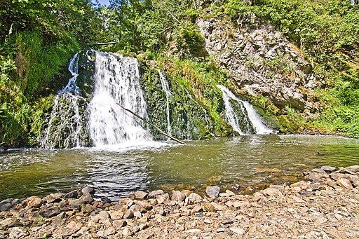
![]() This walk visits the Sloc of Dess Waterfall near Aboyne in Grampian. The secluded falls and surrounding woodland area a lovely place for a quiet walk.
This walk visits the Sloc of Dess Waterfall near Aboyne in Grampian. The secluded falls and surrounding woodland area a lovely place for a quiet walk.
There's some roadside parking on the road next to the falls. Then follow the paths east down to the falls on the Dess Burn. Take care going down the hill to the waterfall as it can be tricky especially when wet. With a bit of effort you will soon come to the delightful spot which is generally very quiet and peaceful.
There are other paths you can then follow around Dess Wood.
The falls can also be approached from the east in Kincardine O'Neil where there is more parking available.
Postcode
AB34 5BB - Please note: Postcode may be approximate for some rural locationsDess Waterfall Ordnance Survey Map  - view and print off detailed OS map
Dess Waterfall Open Street Map  - view and print off detailed map
*New* - Walks and Cycle Routes Near Me Map - Waymarked Routes and Mountain Bike Trails>>
Dess Waterfall OS Map  - Mobile GPS OS Map with Location tracking
Dess Waterfall Open Street Map  - Mobile GPS Map with Location tracking
Pubs/Cafes
Belwade Farm is located just to the south of the waterfall. It's a lovely place to visit with a number of horses and ponies to meet. There's pleasant nature walks which will take you through beautiful woodland and along the River Dee as it travels through Aberdeenshire.
The site also includes a fine cafe with a varied menu including locally produced dishes prepared in house by their chef. You can enjoy your meal with fabulous views over the farm knowing that all proceeds will go towards helping look after the horses in their care. You can find the farm at postcode AB34 5BJ.
Further Information and Other Local Ideas
Just a few miles to the west there's the Loch of Aboyne to visit.
Head west to Ballater and you could pick up the popular 7 Bridges Walk.
Just to the south you can pick up the Deeside Way. The shared cycling and walking route runs along a disused railway between Aberdeen and Ballater.
For more walking ideas in the area see the Cairngorms Walks page.


