Dorset Cursus Walk
![]()
![]() This circular walk visits the Dorset Cursus in the Cranborne Chase AONB. The historic area includes several long barrows, tumuli and wonderful views over some beautiful countryside and woodland.
This circular walk visits the Dorset Cursus in the Cranborne Chase AONB. The historic area includes several long barrows, tumuli and wonderful views over some beautiful countryside and woodland.
As well as exploring the ancient site the walk also climbs to Gussage Hill and visits the village of Gussage St Michael.
Start the walk from the parking area on Wyke Down at the eastern end of the cursus. Then head south west past Down Farm, following the course of the cursus towards Cashmoor. The Neolithic earthwork enclosure comprises parallel banks spanning over 6 miles of chalk downland.
The route then heads south to visit the small village of Gussage St Michael. The village includes a Grade I listed church with parts dating to the 12th century.
From here you head north east to climb to Gussage Hill. The hill stands at a height of 117 metres providing excellent views right across the cursus. You then follow a bridle path past Harley Wood before returning to the car park.
Postcode
SP5 5RX - Please note: Postcode may be approximate for some rural locationsDorset Cursus Ordnance Survey Map  - view and print off detailed OS map
Dorset Cursus Open Street Map  - view and print off detailed map
Dorset Cursus OS Map  - Mobile GPS OS Map with Location tracking
Dorset Cursus Open Street Map  - Mobile GPS Map with Location tracking
Further Information and Other Local Ideas
To continue your walking in the area you could try the Tarrant Monkton and Chettle Walk which visits the 18th century Chettle House and the south western terminus of the cursus on Thickthorn Down. There's also the 17th century Langton Arms thatched pub to visit in Tarrant Monkton on the walk.
Cycle Routes and Walking Routes Nearby
Photos
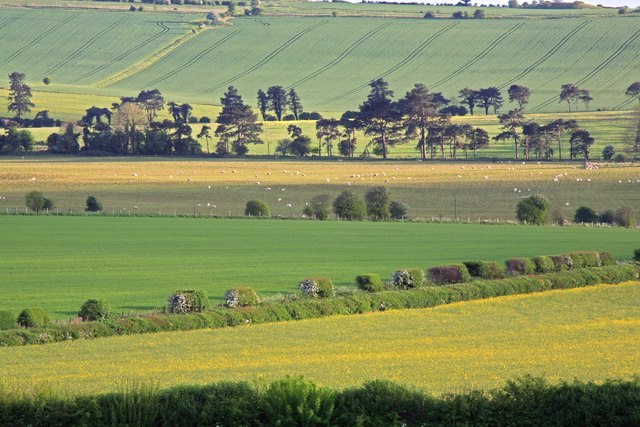
Down Farm, Dorset Cursus. The track of the northerly Dorset Cursus can just be made out, a shallow depression from front centre to the walkers, and then further across Gussage Down. The cursus, now ploughed out in most sections, is a double embankment running for 10km from Thickthorn Down to Pentridge. Thinking is that it was a ceremonial track.
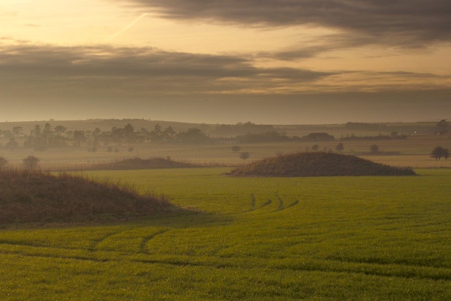
Wyke Down barrows. A view from the bridleway on the Roman 'Ackling Dyke' at the point where it crosses the neolithic Dorset Cursus. The two barrows in shadow in the foreground are bronze-age burial mounds, with the one on the left "within" the parallel banks of the Cursus, and the other "without". There is a real layering of different ages here with neolithic, bronze-age and Roman.
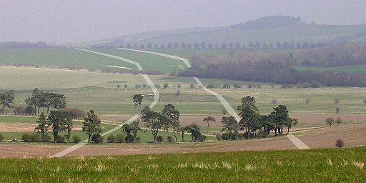
View northeast from Gussage Hill towards Bottlebush Down. The approximate course of the banks of the neolithic Dorset Cursus is superimposed on the photograph in white. It has been conjectured that cursus were used in rituals connected with ancestor veneration, that they follow astronomical alignments or that they served as buffer zones between ceremonial and occupation landscapes. Evidence also suggests they may have been used for ceremonial competitions and a proving ground for young men involving a journey to adulthood.


