Dunnottar Woods
![]()
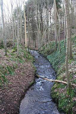
![]() These attractive woods in Stonehaven have miles of waymarked walking trails to try.
These attractive woods in Stonehaven have miles of waymarked walking trails to try.
There's a parking area at the southern end of the woods by Glaslaw Bridge. From here you can pick up a nice path running along the Burn of Glaslaw. On the route you will pass follies and other structures of the Kennedy family, who once owned the woods. Look out for the old Shell House and Lady Kennedy's bath as you make your way through the site.
Dunnottar Wood is located just to the south of Stonehaven. To extend your walk you could follow Carron Water east to the coast and enjoy a walk along Stonehaven Bay.
About a mile to the south east you will find the splendid Dunnotar Castle. The 15th century ruined fortress sits on a rocky headland surrounded by steep cliffs. Dunnottar is best known as the place where the Honours of Scotland, the Scottish crown jewels, were hidden from Oliver Cromwell's invading army in the 17th century. It's an impressive sight and a great place to extend your outing.
You can see more details on the Stonehaven to Dunnottar Castle Walk.
Postcode
AB39 3XX - Please note: Postcode may be approximate for some rural locationsDunnottar Woods Ordnance Survey Map  - view and print off detailed OS map
Dunnottar Woods Open Street Map  - view and print off detailed map
Dunnottar Woods OS Map  - Mobile GPS OS Map with Location tracking
Dunnottar Woods Open Street Map  - Mobile GPS Map with Location tracking
Further Information and Other Local Ideas
To the south you can visit the wildlife rich RSPB Fowlsheugh nature reserve and pick up the coastal Inverbervie to Gourdon Walk and the Gourdon to Johnshaven Walk.
Cycle Routes and Walking Routes Nearby
Photos
Lady Kennedy's Bath, Dunnottar Woods, Stonehaven. This is an oval-shaped stone-built structure said to be the remains of the bathing place of the local laird's wife.
Bridge over Carron Water. The river runs along the western side of the woods. The river discharges into the North Sea at Stonehaven Bay.


