Eccup Reservoir Circular Walk
![]()
![]() Enjoy an easy, circular waterside walk around this lovely reservoir near Leeds.
Enjoy an easy, circular waterside walk around this lovely reservoir near Leeds.
The walk begins in the car park on Stair Foot lane in Adel Woods and follows the Dales Way past Sand Moor golf course to the reservoir. You'll pass through Eccup and then follow a bridleway to Owlet Hall before turning south and enjoying waterside sections along the eastern and southern edges of the reservoir. The walk then passes Alwoodley Old Hall before a woodland section returns you to the Dales Way.
The area is well known for being a great place for birdwatching. In particular look out for Red Kites as you make you're way round the reservoir.
If you would like to continue your walking in the area then you could pick up the Leeds Country Way at Eccup and follow it to the splendid Harewood House where you will find 100 acres of landscaped gardens. If you follow it west then you will soon come to the lovely Golden Acre Park. Here you can pick up the Meanwood Valley Trail which will take you to Woodhouse Moor in Leeds city centre, via Meanwood Park and Adel Woods.
A short distance to the east is the lovely Hetchell Woods Nature Reserve.
The site includes the fascinating historic site of Pompocali where there are extensive earthworks on the course of an old Roman Road.
Postcode
LS17 5EW - Please note: Postcode may be approximate for some rural locationsEccup Reservoir Ordnance Survey Map  - view and print off detailed OS map
Eccup Reservoir Open Street Map  - view and print off detailed map
Eccup Reservoir OS Map  - Mobile GPS OS Map with Location tracking
Eccup Reservoir Open Street Map  - Mobile GPS Map with Location tracking
Pubs/Cafes
Just to the north of the reservoir you'll find the handily placed New Inn. The friendly pub does really good food and has a cosy fire indoors. Outdoors there's a large garen area to relax in on warmer days. To reach the pub just head past Thorn Bush Farm at the north western corner of the water. The pub is located on Eccup Lane with a postcode of LS16 8AU for your sat navs.
Dog Walking
The reservoir and its surrounding woods are a great place for a dog walk. The New Inn mentioned above is also dog friendly.
Further Information and Other Local Ideas
Adel Woods at the start of the route is well worth some further exploration. There's lots of nice trails with a wonderful variety of habitats – woodland, open meadows, heathland, two streams, a pond and a large bog with unusual plant species.
If you're coming by public transport one nice way of visiting the reservoir is to catch the train to Hosforth station. Near here you can pick up the Leeds Country Way and follow it east to Golden Acre Park and the reservoir. It's a couple of miles but it's a great way to visit two of the highlights of the area without the car.
The Bramhope Circular Walk visits the reservoir and Golden Acre Park from the nearby village. The attractive settlement is located just north of the park and includes a fine 18th century pub. You can follow the Ebor Way from here to the popular viewpoints at Otley Chevin Country Park, another of the area's walking highlights.
Just to the north west you can pay a visit to one of the architectural highlights of the area at Arthington Viaduct. The historic Grade II listed structure is well worth a visit with some nice walks along the Wharfe to enjoy.
Cycle Routes and Walking Routes Nearby
Photos
Eccup Reservoir. The open water area is 91 hectares (220 acres), making it the largest area of water in West Yorkshire. It is owned by Yorkshire Water.
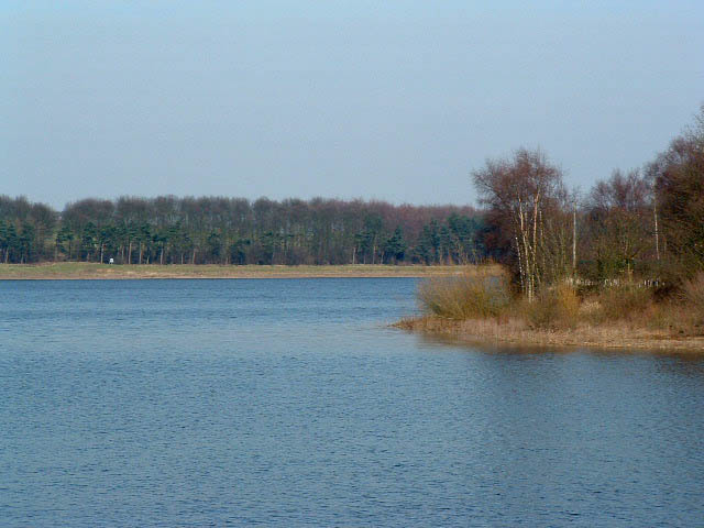
Across the inlet on south side of Eccup Reservoir. The lake is designated as a Site of Special Scientific Interest because of its unique mix of plant life and significant bird populations. The reservoir’s western margins are especially rich in vegetation, with fringing plants such as shore-weed, amphibious bistort, and a variety of sedges including the locally rare bladder sedge, alongside bulrush and common spike-rush. This aquatic and semi-aquatic flora creates a habitat that supports a diverse array of wildlife. In terms of fauna, the reservoir is a vital wintering site for wildfowl. Species such as wigeon, teal, pochard, shelduck, shoveler, ruddy duck, mallard, and tufted duck are commonly observed, with the goosander being particularly notable as it accounts for up to two percent of Britain’s wintering population. Migratory waders like curlew, redshank, and common sandpiper also frequent the area, and red kites can often be seen soaring overhead.
Footpath by Goodrick Plantation. Much of the south-west side of the reservoir is hidden by the trees.
High Wood from the reservoir dam. This view is looking west from the dam. From this spot you are very likely to see red kite. Eccup is also visited by large numbers of migrating and overwintering wading birds and waterfowl. The most significant of these is the goosander, with up to 2% of the British population overwintering here. Others include wigeon, teal, pochard, shelduck, shoveler, ruddy duck, goldeneye, greylag goose, dunlin and green sandpiper, while mallard and tufted duck are present all year round, as are curlew, redshank and common sandpiper.


