Egglestone Abbey Circular Walk
![]()
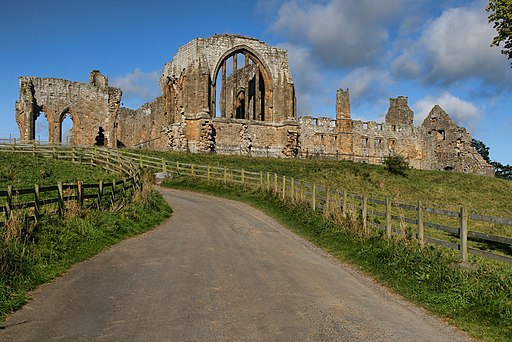
![]() This circular walk visits the remains of the 12th century Egglestone Abbey near Barnard Castle in County Durham.
This circular walk visits the remains of the 12th century Egglestone Abbey near Barnard Castle in County Durham.
The ancient abbey sits in a scenic riverside location making it an ideal location for a peaceful walk. The site is run by English Heritage and additionally includes a 13th century church.
This circular walk starts from the abbey car park where you can directly explore the atmospheric ruins. You can then follow footpaths on both sides of the river to create a circular walk through the area. Cross the river just to the south of the site on Abbey Bridge and you can pick up the Teesdale Way to take you toward Barnard Castle. Other public footpaths will then lead you back to the abbey on the western side of the river.
It's about a 5 mile walk on fairly flat paths so should take just under 2 hours to complete.
Postcode
DL12 9TH - Please note: Postcode may be approximate for some rural locationsPlease click here for more information
Egglestone Abbey Ordnance Survey Map  - view and print off detailed OS map
Egglestone Abbey Open Street Map  - view and print off detailed map
Egglestone Abbey OS Map  - Mobile GPS OS Map with Location tracking
Egglestone Abbey Open Street Map  - Mobile GPS Map with Location tracking
Further Information and Other Local Ideas
Head south east along the river and you will soon come to Greta Bridge and the Meeting of the Waters. It's a scenic spot where the River Tees and the River Greta meet. The village also includes the noteworthy Morrit Arms, an historic hotel dating back to the 17th century. The area has literary connections with Charles Dickens who researched his novel 'Nicholas Nickleby' here.
Cycle Routes and Walking Routes Nearby
Photos
Egglestone Abbey. The Grade I listed Abbey was dissolved in 1540 by king Henry VII. Eventually, much of the abbey was pulled down and some of the stonework was used to pave the stable yard at the nearby Rokeby Park in the 19th century.
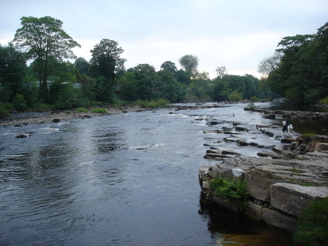
Tees at low flow below East Lendings. Once away from Barnard Castle, the River Tees flattens out and flows fairly quietly past East Lendings caravan park on the right bank, and farmland on the left (from where the photograph was taken).


