Emley Circular Trail
![]()
![]() This circular walk explores the area around the historic village of Emley in Kirklees.
This circular walk explores the area around the historic village of Emley in Kirklees.
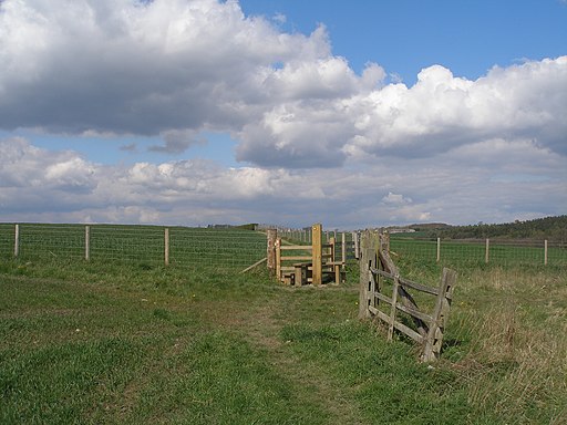
The 6 mile trail visits the Emley Millennium Green before heading up into the surrounding countryside with glorious views of the Upper Dearne Valley.
The route starts in the village by the post office and then heads south past the Millennium Green and Churchhill Farm towards Clayton West. This section includes views of the River Dearne and the photogenic old packhorse bridge in Clayton West.
Here you will cross the River Dearne and pick up a section of the Kirklees Way, a long distance waymarked trail running through the area.
Follow the footpath north to Woodhouse Farm and Furnace Grange where you turn west to Upper Crawshaw. From here you turn south east to return to the village.
At the southern end of the route you could extend your outing by picking up the Dearne Way and following it east along the river to the nearby Bretton Country Park. There's some pleasant waterside paths around a pretty lake and miles of peaceful woodland to enjoy here. The site also includes the wonderful Yorkshire Sculpture Park which is one of the area's highlights.
Emley Circular Trail Ordnance Survey Map  - view and print off detailed OS map
Emley Circular Trail Open Street Map  - view and print off detailed map
Emley Circular Trail OS Map  - Mobile GPS OS Map with Location tracking
Emley Circular Trail Open Street Map  - Mobile GPS Map with Location tracking
Walks near Emley
- Dearne Way - Travel from Birds Edge to Mexborough along the River Dearne on this delightful riverside walk through Yorkshire.
The footpath begins at Birds Edge, near Holmfirth and heads east through Daton, Barnsley and Bolton Upon Dearne before coming to an end at Mexborough - Kirklees Way - Explore the Kirklees metropolitan district on this challenging circular walk through West Yorkshire
- Bretton Country Park - This country park includes 500 acres of lakes and parkland, housing various sculptures as well as being the home of several endangered species
- Denby Dale - This walk visits the village of Denby Dale in West Yorkshire
- Cannon Hall Country Park - Explore the beautiful lansdscaped gardens of Cannon Hall in Cawthorne, Yorkshire
- Deffer Wood - This circular walk visits Deffer Wood in West Yorkshire
- Broadstone Reservoir - This walk visits Broadstone Reservoir near Barnsley and Huddersfield


