Entwistle Reservoir Walk
![]()
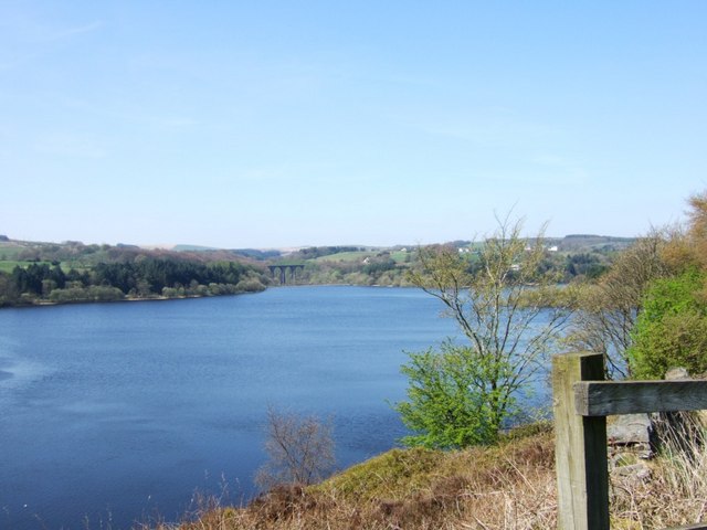
![]() This circular walk follows the waterside footpath around Turton and Entwistle Reservoir near Bolton in Lancashire. The walk starts from the car park at the eastern end of the reservoir but you could also start from the nearby Entwistsle railway station. Trains run to Entwistle from Manchester, Blackburn and Clitheroe.
This circular walk follows the waterside footpath around Turton and Entwistle Reservoir near Bolton in Lancashire. The walk starts from the car park at the eastern end of the reservoir but you could also start from the nearby Entwistsle railway station. Trains run to Entwistle from Manchester, Blackburn and Clitheroe.
There is a good, well surfaced footpath around the reservoir, running for about 2.5 miles. It's a popular place for walkers with the beautiful still waters surrounded by attractive conifer trees. After your walk you can treat yourself to refreshments at the excellent Strawberry Duck pub located to the east of the reservoir, near the train station.
It's easy to extend your walk by picking up the Witton Weavers Way and following it south to the lovely Jumbles Country Park via Wayoh Reservoir.
Postcode
BL7 0LU - Please note: Postcode may be approximate for some rural locationsEntwistle Reservoir Ordnance Survey Map  - view and print off detailed OS map
Entwistle Reservoir Open Street Map  - view and print off detailed map
Entwistle Reservoir OS Map  - Mobile GPS OS Map with Location tracking
Entwistle Reservoir Open Street Map  - Mobile GPS Map with Location tracking
Pubs/Cafes
The Strawbury Duck is conveniently located just to the east of the reservoir. It's one of the area's landmark pubs and well worth a visit after your walk. There's an appealing interior with old beams, an open fire, numerous pictures on the wall, comfy chairs & a cosy, welcoming atmosphere. Outside there's a nice beer garden for warmer days. You can find it close to the train station on Overshores Rd with a postcode of BL7 0LU for your sat navs.


Pictured above are the Strawbury Duck Pub and the adjacent Wayoh Reservoir. A visit to both is a nice idea after your exercise.
Dog Walking
The reservoir path and the surrounding woods are a fine place for a dog walk. The Strawberry Duck pub mentioned above is also dog friendly.
Further Information and Other Local Ideas
Follow the Witton Weavers Way south for about a mile or so and you will come to Turton Tower. This historical landmark dates back to the Middle Ages and includes pleasant grounds with woodland and pretty gardens. There's a delightful tea room with a terraced garden which makes a fine place for some post walk refreshments as well.
For more walking ideas in the area see the West Pennine Moors Walks page.
Cycle Routes and Walking Routes Nearby
Photos
End of the reservoir. The Commissioners were appointed under the provisions of the Turton and Entwistle Reservoir Act of 1832 to construct a reservoir in order to improve the supply of water for power to the owners of factories on the Bradshaw Brook and on the Rivers Eagley, Irwell and Mersey. This is the northernmost of the 3 reservoirs, the other being Wayoh and Jumbles.


