Exmouth to Lympstone Walk
![]()
![]() This popular walk takes you along the River Exe from Exmouth to the pretty village of Lympstone. The route runs for a distance of just over 2 miles, with the option of catching the train back at the end of the walk.
This popular walk takes you along the River Exe from Exmouth to the pretty village of Lympstone. The route runs for a distance of just over 2 miles, with the option of catching the train back at the end of the walk.
The walk starts just to the west of the train station where you can pick up the East Devon Way and follow it along the Exe Estuary. The estuary is very beautifiul and includes the Exe Estuary Nature Reserve. The RSPB reserve is great for birdwatching so look out for avocets, lapwings, redshanks and Cetti's warblers as you make your way along the path.
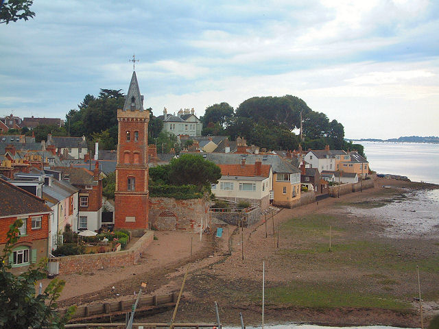
The route finishes in Lympstone where there is an attractive harbour and pretty cottages in the village. Look out for the distinctive Peter's Tower, an Italianate riverfront brick clock tower built around 1885 by W.H. Peters as a memorial to his wife. The riverside houses back directly on to the shore, with no continuous seawall, so the passageways between them to the beach are equipped with metal flood gates that are closed by residents when they are warned of incoming high tides.
The village has a number of fine cafes and pubs where you can stop for refreshments after your exercise. The Swan Inn has a good menu and a beer garden to sit out in. You can find it on The Strand at postcode EX8 5ET. Susannah's Tea Room is another great option and also located on The Strand. You can enjoy a lovely Devon cream tea in the outdoor seating area.
To continue your walking in the area you could head east along the coast path on the Exmouth to Sidmouth Walk. Continuing north along the Exe Estuary will take you to Topsham.
Exmouth to Lympstone Walk Ordnance Survey Map  - view and print off detailed OS map
Exmouth to Lympstone Walk Open Street Map  - view and print off detailed map
Exmouth to Lympstone Walk OS Map  - Mobile GPS OS Map with Location tracking
Exmouth to Lympstone Walk Open Street Map  - Mobile GPS Map with Location tracking
Cycle Routes and Walking Routes Nearby
Photos
The Exe Estuary from Exmouth, South Devon. Much of this is a nature reserve and is famous for the presence of Avocets and other migratory birds.
Lympstone village is on the east side of the Exe estuary, Devon. Many of the shoreside houses back directly on to the beach, where there are traditional poles for washing lines. The central tower is the Italianate brick Peter's Tower, an 1885 commemorative clock tower.
Lympstone Harbour The Lympstone Fishery and Harbour Association is responsible for the administration of the Lympstone harbour area and the maintenance of the harbour walls. Improvements to the walls have been made recently. At low water, as here, the harbour dries out completely. Full access to the harbour is only available two hours either side of high water.


