Farnborough Hall Walks
![]()
![]() This National Trust owned site is located in the village of Farnborough in rural Warwickshire.
This National Trust owned site is located in the village of Farnborough in rural Warwickshire.
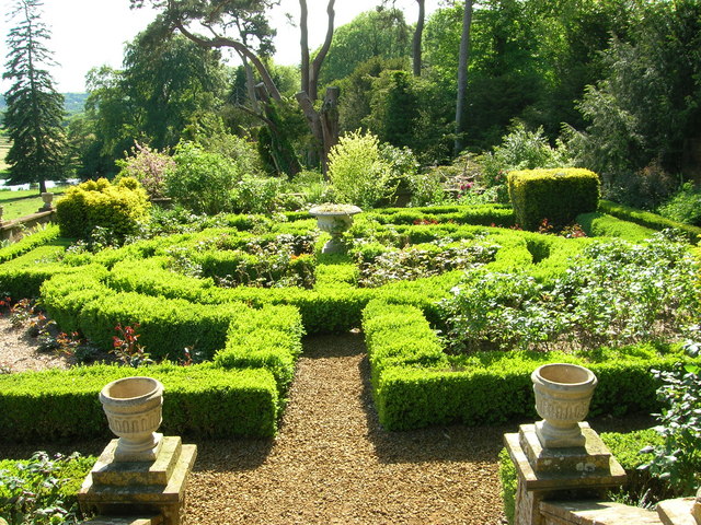
The Grade I listed hall dates from the 18th century and is surrounded by attractive parkland with lakes and beautiful landscaped gardens.
This circular walk from the hall explores the countryside to the north of the site. You'll pass Avon Dassett, Shooter's Hill, Hall's Hill and Windmill Hill before passing through Farnborough village. On the way there's some nice country views from the high points and lots of wildlife to see. Keep your eyes peeled for Kingfisher, moorhens, long tailed tits, gold crests, and tree creepers.
The D'arcy Dalton Way passes the hall on the eastern side. This waymarked long distance trail starts off just to the north at Wormleighton Reservoir and heads south through the Cotswolds towards Ashbury. It's a good way of further stretching your legs if you have time.
Please click here for more information
Farnborough Hall Ordnance Survey Map  - view and print off detailed OS map
Farnborough Hall Open Street Map  - view and print off detailed map
Farnborough Hall OS Map  - Mobile GPS OS Map with Location tracking
Farnborough Hall Open Street Map  - Mobile GPS Map with Location tracking
Walks near Farnborough
- Avon Dassett - This pretty little Warwickshire village is located in a lovely spot on the edge of the Cotswolds
- Burton Dassett Hills Country Park - This super country park is comprised of a group of ironstone hills which rise to 203m (667 ft)
- Banbury - Explore the area surrounding the Oxfordshire town of Banbury on this long circular walk
- Warwick - A circular walk around the town of Warwick, visiting the castle, the River Avon and the Grand Union Canal.
- Warwickshire Centenary Way - Starting at Kingsbury Water Park (video below) in the north of the county this lovely walk takes you through the River Tame Valley, Atherstone Ridge, Nuneaton, Coombe Abbey Park at Coventry (video below), Kenilworth, Warwick, Leamington Spa, Burton Dassett Hills, Avon Dassett, Edge Hill, Shipston on Stour and Ilmington Downs.
- Oxford Canal Walk - Follow the Oxford Canal from Oxford to Coventry on this splendid waterside walk
- Clattercote Reservoir - This small reservoir is located just south of Claydon in Oxfordshire.
- Boddington Reservoir - Enjoy a peaceful walk around this pretty reservoir near Banbury
- Broughton Castle - Enjoy a short stroll around Broughton Castle and Broughton park on this interesting walk in Oxfordshire
- Wroxton Abbey - This walk explores the Oxfordshire village of Wroxton and the splendid grounds of a fine Jacobean mansion
- Bodicote Circular Walk - This short circular walk explores the countryside around the Oxfordshire village of Bodicote near Banbury
- Kings Sutton - This attractive West Northamptonshire village is a lovely place to start a walk
- Adderbury Circular Walk - This three mile circular walk explores the countryside around the Oxfordshire villages of Adderbury and Bodicote
- Adderbury Lakes - Enjoy a short walk around this pretty nature reserve in the Oxfordshire village of Adderbury
- Southam - The Warwickshire market town of Southam is located in the Stratford-on-Avon district of the county
- Harbury - This pretty village is located close to Southam and Leamington Spa in the county of Warwickshire
- Tysoe Windmill - This walk visits the historic Tysoe Windmill in the Stratford-on-Avon District of Warwickshire.
- Darcy Dalton Way - This long distance walking trail runs through the Oxfordshire countryside from Wormleighton Reservoir to Wayland's Smithy near Ashbury.
Further Information and Other Local Ideas
Head west and you can visit the neighbouring village of Avon Dassett. Here you can pick up the Warwickshire Centenary Way and follow the waymarked footpath north to the splendid Burton Dassett Hills Country Park.
A few miles to the west there are some nice woodland trails on Edge Hill. Here you'll find some fine views and the site of the Battle of Edgehill, the first battle of the English Civil War fought in 1642. The area includes an excellent, elevated pub where you can enjoy views over the battlefield.
Near here is the worthy village of Tysoe where you could enjoy a climb to the Tysoe Windmill. The photogenic old mill sits on top of a 184 metre hill with excellent views over the Cotswolds.
Just to the east you could enjoy some waterside walking along the Oxford Canal Walk or around the pretty Clattercote Reservoir.
For more walking ideas in the area see the Warwickshire Walks and the Cotswolds Walks pages.
Photos
Farnborough Hall. Rear view of the honey-coloured stone house. The hall has been owned by the National Trust since 1960 when the Holbech family endowed it to them. It is still run for the National Trust by Geoffrey Holbech's daughter Caroline Beddall.


