Farne Islands
![]()
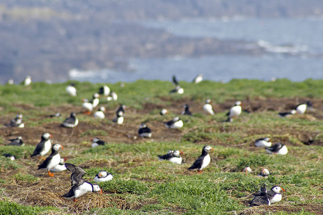
![]() The Farne Islands are located just 1.5 miles from the Northumberland Coast at Bamburgh. You can catch a boat from Seahouses harbour to Inner Farne, the largest of the islands. Here you can see colonies of grey seals and up to 37000 pairs of puffins. The islands attract many other seabirds including Guillemots, Razorbills, Sandwich Terns, Common Terns, Roseate Terns, Arctic Terns, Shags, Cormorants and Eider Ducks. There is a lovely walkway around Inner Farne taking you past the interesting buildings which date from the monastic period. These include the remains of the old Guest House, the Chapel of St Cuthbert with fine stained-glass windows and the Pele Tower. The islands are run by the National Trust so entry is free for members.
The Farne Islands are located just 1.5 miles from the Northumberland Coast at Bamburgh. You can catch a boat from Seahouses harbour to Inner Farne, the largest of the islands. Here you can see colonies of grey seals and up to 37000 pairs of puffins. The islands attract many other seabirds including Guillemots, Razorbills, Sandwich Terns, Common Terns, Roseate Terns, Arctic Terns, Shags, Cormorants and Eider Ducks. There is a lovely walkway around Inner Farne taking you past the interesting buildings which date from the monastic period. These include the remains of the old Guest House, the Chapel of St Cuthbert with fine stained-glass windows and the Pele Tower. The islands are run by the National Trust so entry is free for members.
To continue your walking in the area try the Seahouses to Bamburgh walk and visit the fascinating coastal castle. The long distance St Oswald's Way also passes the islands and is a great way to explore the Northumberland Coast AONB.
Please click here for more information
Farne Islands Ordnance Survey Map  - view and print off detailed OS map
Farne Islands Open Street Map  - view and print off detailed map
Farne Islands OS Map  - Mobile GPS OS Map with Location tracking
Farne Islands Open Street Map  - Mobile GPS Map with Location tracking
Further Information and Other Local Ideas
For more walking ideas in the area see the Northumberland Walks page.
Cycle Routes and Walking Routes Nearby
Photos
St Cuthbert's Chapel on Inner Farne, 3 km from Red Barns, Northumberland. This monastic chapel dates from the fourteenth century. It fell out of use after the dissolution of the monasteries under Henry VIII and by the end of the eighteenth century had become derelict. Much restoration was undertaken by Archdeacon Charles Thorpe in the mid nineteenth century and extensive repairs were carried out by the National Trust in 1929.
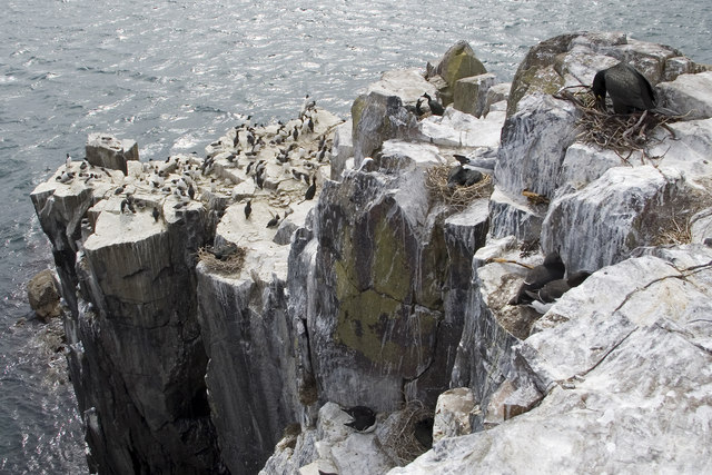
Sea cliffs. This is the view from the end of the path past the lighthouse. The visitor can get to within a few feet of nesting shags. The other birds in the picture are guillemots.
Path towards the lighthouse. To avoid disturbing the birds, visitors to Inner Farne must keep to the roped off paths. The present lighthouse dates from 1811, has been operated automatically since 1910 and by solar power since 1996.


