Foggintor Quarry Walk
![]()
![]() This circular walk takes you from Princetown to the Foggintor Quarries on Dartmoor. The route also climbs to the nearby King's Tor for fine views over the area.
This circular walk takes you from Princetown to the Foggintor Quarries on Dartmoor. The route also climbs to the nearby King's Tor for fine views over the area.
The walk starts from the public car park in the village of Princetown, just to the east of the site. From here you can pick up a section of the Dartmoor Way and follow the waymarked footpath west along a dismantled railway line. After about 1.5 miles you turn north to follow a footpath to the quarry. Here you'll find a tranquil lake surrounded by the atmospheric quarry ruins. It's a photogenic spot which also gives an insight into the areas mining heritage.
After exploring the quarry you continue west to visit the neighbouring Swelltor Quarries before climbing up to King's Tor. There's excellent views over the National Park from this elevated location. The trail then loops around the hill before returning to Princetown on an alternative bridleway.
Postcode
PL20 6SS - Please note: Postcode may be approximate for some rural locationsFoggintor Quarry Ordnance Survey Map  - view and print off detailed OS map
Foggintor Quarry Open Street Map  - view and print off detailed map
Foggintor Quarry OS Map  - Mobile GPS OS Map with Location tracking
Foggintor Quarry Open Street Map  - Mobile GPS Map with Location tracking
Pubs/Cafes
Back in Princetown The Plume Of Feathers Inn is a fine choice for some post walk refreshment. The historic pub dates back to 1785 and retains many of its original features such as slate floors, wooden beams and granite walls. Inside there's a cosy fire for the winter, while outside there's a lovely garden if the sun is shining. They serve high quality food using fresh, seasonal local produce. You can find them at Plymouth Hill with a postcode of PL20 6QQ for your sat navs.
Dog Walking
The trails make for a fine dog walk and the Plume Of Feathers mentioned above is also dog friendly.
Further Information and Other Local Ideas
The circular Princetown Walk uses part of the Abbot's Way and the Dartmoor Way to North Hessary Tor and the ancient bronze age settlement of Merrivale.
Head a few miles south and you can enjoy a climb to Sharpitor and visit the splendid Burrator Reservoir where there's a nice waterside walking trail.
Just to the north west you'll find the climb to Great Staple Tor and Roos Tor. The Merrivale Quarry and the Merrivale Prehistoric Settlement can also be found in this interesting and attractive area.
For more walking ideas in the area see the Dartmoor Walks page.
Cycle Routes and Walking Routes Nearby
Photos
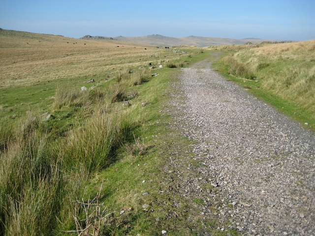
Dartmoor: Former Yelverton to Princetown railway. You can follow this trail to the quarry from Princetown. It is the trackbed of the former Yelverton to Princetown railway that opened in 1883 and closed in 1956. Here the railway traverses the slopes of North Hessary Tor, near the quarry. The trackbed here now forms a section of the long distance footpath of the Dartmoor Way. The distant tors visible are, left to right, King's Tor in SX5573, Middle Staple Tor and Great Staple Tor in SX5475, Roos Tor in SX5476, and White Tor in SX5478.
Bridge on the former Yelverton to Princetown railway. This is the other side of Gwyn's 58438. The railway was built on an embankment here across the side slope of North Hessary Tor, and the bridge was built to allow surface water to flow off the moor creating a tributary of the River Walkham.
Disused Princetown Railway Bridge, King's Tor. A sturdy bridge carrying the Plymouth and Dartmoor Railway as it approached Little King Tor. A couple of Dartmoor ponies are taking shelter from the wind in its archway. The line, which opened in 1823, was constructed as a tramroad to carry stone from Foggintor Quarry off the moor. It was later adapted in 1882 as the GWR branch line from Yelverton to Princetown. The line finally closed in March 1956 due to dwindling use (prior to the Beeching cuts), and the track removed a year later.
King's Tor. None of the current Ordnance Survey maps gives a height for King's Tor but Victorian versions show a spot level of 1314 feet, presumably for the highest point, which is almost exactly 400 metres above sea level. A group of people on top give an indication of scale. Possibly because the quality of the granite was not as good as to be found in the neighbouring tors, Foggintor and Swelltor, King's Tor has only slightly been altered by quarrying works.


