Giddy Edge Walk
0.8 miles (1.3 km)
![]()
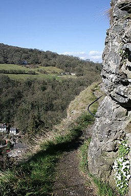
![]() This walk climbs to Giddy Edge and High Tor in Matlock Bath in the Peak District. The elevated, narrow winding path runs along the cliff edge high above the town of Matlock below.
This walk climbs to Giddy Edge and High Tor in Matlock Bath in the Peak District. The elevated, narrow winding path runs along the cliff edge high above the town of Matlock below.
The walk starts from the train station in Matlock Bath. From here you can follow paths north up to Giddy Edge. From here there are excellent views over Matlock Dale to the surrounding Peak District Hills.
You can also pick up the Heights of Abraham cable car near here and travel up to another spectacular viewpoint.


