Gordano Round
![]()
![]() This figure of eight walk takes you on a tour of the coast, countryside, woodland and villages around Portishead in Somerset.
This figure of eight walk takes you on a tour of the coast, countryside, woodland and villages around Portishead in Somerset.
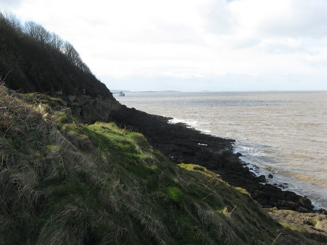
You start in the town centre of Portishead and soon join the splendid coastal path along the Severn Estuary which takes you past Walton, Charlcombe, Ladye and Margaret's Bay. At Clevedon the route then heads inland through some delightful countryside, passing through the pretty village of Clapton in Gordano before returning to Portishead.
The walk was devised by the Gordano Footpath Group and is waymarked with their symbol throughout.
In Portishead you can visit Portsbury Wharf on our Portishead Nature Reserve Walk. There's lots of wildlife to see with two large pools, several ponds, grazing marsh, hay meadows and hedgerow.
Just to the south of Clevedon you could try the Poets Walk which takes you along cliff tops associated with various poets who visited the area.
Please click here for more information
Gordano Round Ordnance Survey Map  - view and print off detailed OS map
Gordano Round Open Street Map  - view and print off detailed map
Gordano Round OS Map  - Mobile GPS OS Map with Location tracking
Gordano Round Open Street Map  - Mobile GPS Map with Location tracking
Pubs/Cafes
One nice place for a pit stop is the historic Black Horse Inn in the little village of Clapton-in-Gordano. The ancient pub dates back to the 14th century and includes ppen fires for the winter months and a glorious display of hanging baskets from late spring. Also known as The Kicker you can find them at postcode TA1 1UD. The pub has a nice garden and is also dog friendly.
Cycle Routes and Walking Routes Nearby
Photos
The lake at Woodhill, Portishead. The trail route was first suggested by Jim Dyer of the Gordano Footpath Group in 1983 and walked by four members of the group in 1984. It was adopted by North Somerset Council as a recreational route and now marked on the Ordnance Survey Explorer map 154. The route is described in the book The Gordano Round first published in 2000. A memorial to Jim Dyer who died in 2012 was set up on the Portishead Coast path on the route in 2014
Abbots Pool. You will pass this pretty lake near Abbots Leigh. The area has some history having been part of a series of pools used by medieval monks for the practice of farming for fish. There's also some pleasant woodland trails and lots of wildlife to see in this peaceful area.
Elevation Profile


