Green London Way
![]()
![]() Explore the best and most beautiful of London's open spaces on this circular walk through the capital. The route has been split up into 18 sections as follows:
Explore the best and most beautiful of London's open spaces on this circular walk through the capital. The route has been split up into 18 sections as follows:
1. Stratford to North Woolwich
2. Abbey Wood and Shooters Hill
3. Woolwich to Greenwich
4. Greenwich to Forest Hill
5. Forest Hill to Crystal Palace
6. Crystal Palace to Balham
7. Balham to Wimbledon
8. Wimbledon to Richmond
9. Richmond to Kew Bridge
10. Kew Bridge to Hanwell
11. Hanwell to Greenford
12. Greenford to South Kenton
13. South Kenton to Brent Cross
14. Brent Cross to Hampstead
15. Hampstead to Finsbury Park
16. Finsbury Park to Clapton
17. Clapton to Victoria Park
18. Victoria Park to Stratford
You'll pass a series of delightful parks including Wimbledon Common, Richmond Park, Hampstead Heath and Kew Gardens. There are also waterside sections along the River Thames and the Brent River to enjoy.
Please click here for more information
Green London Way Ordnance Survey Map  - view and print off detailed OS map
Green London Way Open Street Map  - view and print off detailed map
Green London Way OS Map  - Mobile GPS OS Map with Location tracking
Green London Way Open Street Map  - Mobile GPS Map with Location tracking
Pubs/Cafes
In Hampstead, one noteworthy place worth consideration is The Spaniards Inn. The pub dates from 1585 and has some interesting literary connections. John Keats apparently penned Ode to a Nightingale in the garden and the pub is also mentioned in Charles Dickens’ Pickwick Papers. There's an attractive interior with oak-panelled walls, chandeliers, beams and log fires. Outside there's a nice garden with a BBQ on warmer days. You can find the inn on Spaniards Road at the north western end of the heath. Postcode for your sat nav is NW3 7JJ.
Further Information and Other Local Ideas
For more walking ideas in the area see the London Walks page.
Cycle Routes and Walking Routes Nearby
Photos
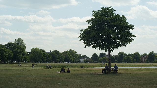
Wimbledon Common. The expansive common is a popular place for walkers and cyclists with miles of wide trails. There's also the iconic windmill which includes an interesting museum detailing the history of the area.
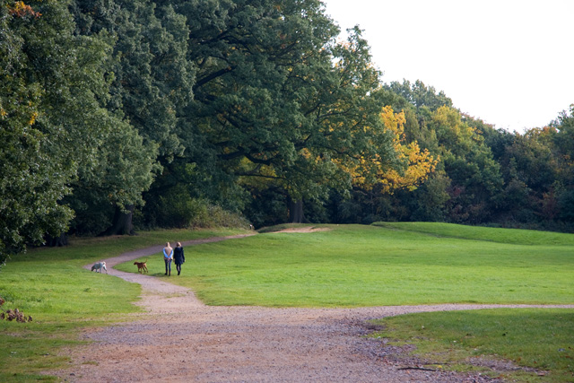
Hampstead Heath. Ladies talk while walking their dogs on a bright autumn morning. This ancient heath sits astride a sandy ridge, one of the highest points in London, running from Hampstead to Highgate, which rests on a band of London Clay. The heath is rambling and hilly, embracing ponds, recent and ancient woodlands, a lido, playgrounds, and a training track, and it adjoins the former stately home of Kenwood House and its estate. The south-east part of the heath is Parliament Hill, from which the view over London is protected by law. Running along its eastern perimeter is a chain of ponds – including three open-air public swimming pools – which were originally reservoirs for drinking water from the River Fleet.
Richmond Park. A wonderful deer park with cycle trails, gardens, views to central London and a golf course. The park is of national and international importance for wildlife conservation. It was created by Charles I in the 17th century as a deer park. It is now a national nature reserve, a Site of Special Scientific Interest and a Special Area of Conservation and is included, at Grade I, on Historic England's Register of Historic Parks and Gardens of special historic interest in England. Its landscapes have inspired many famous artists and it has been a location for several films and TV series.The park ncludes many buildings of architectural or historic interest. The Grade I-listed White Lodge was formerly a royal residence and is now home to the Royal Ballet School.
Richmond Bridge. An 18th-century stone arch bridge that crosses the River Thames at Richmond, connecting the two halves of the present-day London Borough of Richmond upon Thames. It is Grade I listed.
Finsbury Park. The park was one of the first of the great London parks laid out in the Victorian era. The park borders the neighbourhoods of Harringay, Finsbury Park, Stroud Green, and Manor House. It includes a mixture of open ground, formal gardens, avenues of mature trees and an arboretum. There is also a lake, a children's play area, a cafe and an art exhibition space.
The bathing pond at Victoria Park. Unused for bathing since the 1930s, it is now popular with anglers The park (known colloquially as Vicky Park or the People's Park) is located in the London Borough of Tower Hamlets. It is the largest park in Tower Hamlets and one of London's most visited green spaces with approximately 9 million visitors every year. The park spans 86.18 hectares (213.0 acres) of open space and opened to the public in 1845.
Crystal Palace Park. This Victorian pleasure ground is located in the South London suburb of Crystal Palace surrounding the site of the former Crystal Palace Exhibition building. The Palace had been relocated from Hyde Park, London after the 1851 Great Exhibition and rebuilt with some modifications and enlargements to form the centrepiece of the pleasure ground, before being destroyed by fire in 1936. The park features full-scale models of dinosaurs in a landscape, a maze, lakes, and a concert bowl. The park is situated halfway along the Norwood Ridge at one of its highest points. This ridge offers views northward to central London, eastward to the Queen Elizabeth II Bridge and Greenwich, and southward to Croydon and the North Downs.
Elevation Profile


