Greensand Way OS Map and GPX
![]()
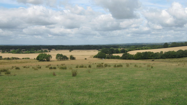
![]() The Greensand Way runs from Haslemere in Surrey to Hamstreet in Kent following the ridge of greensand rock that crosses the two counties. The route takes in two Areas of Outstanding Natural Beauty - the Surrey Hills and the Kent Downs - as well as numerous Sites of Special Scientific Interest. Highlights include
The Greensand Way runs from Haslemere in Surrey to Hamstreet in Kent following the ridge of greensand rock that crosses the two counties. The route takes in two Areas of Outstanding Natural Beauty - the Surrey Hills and the Kent Downs - as well as numerous Sites of Special Scientific Interest. Highlights include
- Gibbet hill - Located at Hindhead, Surrey it is the second highest point in Surrey after Leith Hill. It commands a panoramic view of the beautiful North Downs. The view to the north overlooks the Devil's Punch Bowl , Thursley, Hankley Common, Crooksbury Hill, and the Hog's Back towards Godalming and Guildford. To the east lies the Sussex Weald. To the south, the hills of Haslemere and Blackdown can be seen, with some sections of the South Downs.
- Thursley National Nature Reserve has miles of footpaths through heathland and woodland with a huge variety of wildlife.
- Leith Hill (video below) -the highest point in the South East with fabulous views of the Surrey countryside. It is located near Dorking and is also the highest point on the Greensand Ridge. On the summit of Leith Hill is an 18th century Gothic tower, with panoramic views northwards to London and the English Channel to the south.
- Holmbury Hill - one of the high points of the walk, this hill in Holbury St Mary, commands fine views over the Surrey Hills AONB.
- Winterfold Forest - the trail passes through this expansive wood, popular with mountain bikers.
- Knole Park - Knole House in Sevenoaks is surrounded by a deer park, ancient woodland, dry heathland, acid grassland and wood pasture.
- Riverhill Himalayan Gardens - these delighful gardens have nice footpaths taking you to a walled garden with Himalayan-inspired grass-sculpted terraces and a large pond with fountains. It is located just to the south of Knole Park near Sevenoaks.
- Ightham Mote - this medieval moated manor house in Sevenoaks is surrouned by woodland, gardens and parkland. It's located close to the pretty village of Shipbourne which is one of the most expensive places to live in the country.
- Chartwell House - the family home and garden of Sir Winston Churchill in Westerham, Kent
- Toys Hill - wonderful viewpoint with views over the Weald of Kent. The area has strong connections with Octavia Hill, founder of the National Trust.
- Linton Park - large 18th-century country house in Linton, Kent with beautiful gardens and views of the Weald. The estate is private property and is not open to the public, but the Greensand Way crosses the parkland east-west to the north of the house and a public footpath crosses the southern parkland close to the park lake.
- Crossing the River Medway on The Twyford Bridge, Yalding, Kent
- Limpsfield Common in the Surrey Hills AONB has some nice trails and carpets of bluebells in the spring months.
- The atmospheric ruins of the 12th century Waverley Abbey near Farnham.
- A series of magnificent houses, gardens and parks, which have been built along the ridge.
Please click here for more information
Greensand Way Ordnance Survey Map  - view and print off detailed OS map
Greensand Way Open Street Map  - view and print off detailed map
*New* - Walks and Cycle Routes Near Me Map - Waymarked Routes and Mountain Bike Trails>>
Greensand Way OS Map  - Mobile GPS OS Map with Location tracking
Greensand Way Open Street Map  - Mobile GPS Map with Location tracking
Pubs/Cafes
On the route stop at the pretty village of Holmbury St Mary and you can enjoy refreshments in the Royal Oak. There's a very nice, large outdoor seating area to relax in during the summer months here. It's a quintessentially British country pub; with open fires, home-cooked food, on site brewery and a warm welcome. You can find it at Felday Glade with postcode RH5 6PF for your sat navs. There's also the King's Head on Pitland Street (postcode: RH5 6NP). Here you'll find log fires, pub grub, real ales and another nice garden to sit out in.
The Carpenters Arms is located on the National Trust's Limpsfield Common near Oxted. The 19th century pub does very good food and also has a large garden area to relax in on warmer days. You can find it on Tally Rd, Limpsfield Chart with a postcode of RH8 0TG for your sat navs. The pub is also dog friendly if you have your canine friend with you.
Shipbourne is located close to Tonbridge and Sevenoaks. The pretty village includes a common and The Chaser pub. They do excellent food and have a lovely garden area overlooked by the adjacent old church. It's a fine spot to relax in during the summer months. You can find the pub at Stumble Hill with a postcode of TN11 9PE for your sat navs.
Cycle Routes and Walking Routes Nearby
Photos
View along the Greensand Way, where it runs along the southern edge of the Fort (Scheduled Monument) at the top of Holmbury Hill.
Gibbet Hill High point (272 metres) on Hindhead Common with heather, Celtic Cross, information board and trig point at this viewpoint.
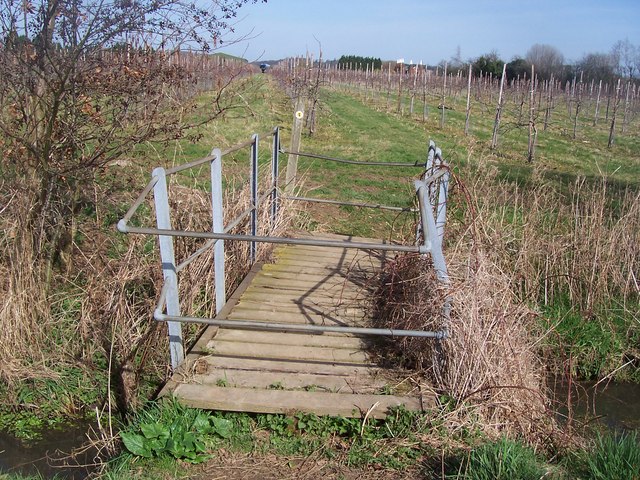
The long distance footpath climbs steps on small ridge in Buston Manor farmland, then it turns right along a newly planted strip of woodland leading to Barn Hill.
Elevation Profile


